Archive | Genealogy RSS feed for this section

Saskatchewan Cemeteries photographed and transcribed online

27 Oct

Ron Isherwood October 09, 1946 – August 09, 2017 enjoyed working on his Saskatchewan Cemeteries Project, and he also had enjoyed doing genealogy research.  Thank you very kindly to the many contributions made by Ron Isherwood, and for his dedication to the Saskatchewan Cemeteries Project, indeed.

burial cemetery cross daylight

The Saskatchewan Cemeteries Project which is now restored and operational online after the hiatus between December 2017 and September 2018.  The Saskatchewan Cemeteries Project is not being updated after 2017, but is kept online in an archived status thanks to Ancestry.com Rootsweb.


NOTE  There are a large number of organizations who are currently compiling cemetery information online which can be viewed at https://sites.rootsweb.com/~cansk/Saskatchewan/cemetery.html

The Canada Gen Web Cemetery Project – Saskatchewan Cemetery Project is a separate project from Ron Isherwood’s Saskatchewan Cemeteries Project and the Canada Gen Web Cemetery Project – Saskatchewan Cemetery Project features submitted transcripts searchable by ancestor’s name for all of Canada or Saskatchewan or by cemetery! Check out this cemetery transcriptions/photographs online project.

Ancestor Recognition Project – Cemetery Preservation: Online Cemetery Digitization courtesy of the Sask Gen Web Project

Online Historical Map Digitization Project

27 Oct

The Online Historical Map Digitization Project https://sites.rootsweb.com/~canmaps/ is now back online. This website was offline between December 2017-September 2018, however the Rootsweb/Ancestry.com IT department has returned the data online, restored and preserved.  Thank you for  your patience.

activity adventure blur business

New maps are expected to go online at the Online Historical Map Digitization Project https://sites.rootsweb.com/~canmaps/ so check this link periodically

Some of the maps and information online as of October 2018 are

Ethnic Bloc Settlements – Atlas of Saskatchewan

1862 Boundaries – Atlas of Saskatchewan

1882 Boundaries – Atlas of Saskatchewan

1895 Boundaries – Atlas of Saskatchewan

1904 Survey of the Dominion of Canada Maps

1905 Boundaries – Atlas of Saskatchewan

1907 Survey of the Dominion of Canada Maps

1910 Census Atlas of the World

1911 Alberta, Saskatchewan Atlas Maps

1911 and 1912 Maps of School Districts in Saskatchewan

1914 Department of Mines Geological Survey, Alberta, Saskatchewan, Manitoba

1914 Key West Rural Municipality 70, Saskatchewan Map

c1916 Cummins Maps, detailed quarter sections of Saskatchewan partial coverage of province

1917 Scarborough’s New Map of Saskatchewan
showing Judicial Districts, Land Registration Districts, Municipalities, Townships and Sections,
Cities (with populations), Villages (populations), Post Offices and Stations, Railway lines with Distances between Stations.

1919 Waghorn’s Railway Guide, Alberta, Saskatchewan, Manitoba

Early Rural Municipality of Turtle River 469, Saskatchewan Historical Homesteader Map

Early Regina, Saskatchewan city map

Early Scandinavian Canada Land Company Map for the area North of Canora, Saskatchewan

Early Stovel’s Pocket Map of Saskatchewan

1922 Gazetteer of United States. and Canadian Railroads

1922 New World Atlas and Gazetteer

1924 Saskatchewan Wheat Pool Map

1924 Rand McNally Indexed Pocket Map

1925 Waghorn’s Railway Guide and Maps, Alberta, Saskatchewan, Manitoba

1925 Saskatchewan Highway Map

c1935-1940 CNR Railway Map Western Canada

1935 Saskatchewan – Regina Sheet [Southern Saskatchewan] Department of mines map

1941 Waghorn’s Railway Guide and Maps, Alberta, Saskatchewan, Manitoba

1947-48 Saskatchewan Wheat Pool Map

1948 Waghorn’s Guide and Maps, Alberta, Saskatchewan Manitoba, Ontario

1950-51 Saskatchewan Wheat Pool Map

1952-53 Saskatchewan Wheat Pool Map

1954 Canadian National Railways Western Lines Map (Western Canada)

1954 Saskatchewan Government Insurance Highway Map of Saskatchewan
issued in cooperation with the Department of Highways and Transportation. Canada. 1954.

1984 Saskatchewan Wheat Pool Map

Canadian National Railway CNR Alphabet Railway Placenames Listing.

Frequently asked questions about the Online Historical Map Digitization Project and the individual maps

1921 Canada census : Place of Habitation : Rural Municipalities [RM]

Where were Saskatchewan homesteads located?

How do I locate my ancestor’s home town?

Maybe the Ghosts will rise again! – A look at Saskatchewan’s Ghost Towns

How do the Saskatchewan 2011 Canadian Census Statistics Compare to History?

Visiting your Ancestor’s Homestead – Planning a summer vacation?

Saskatchewan One Room Schoolhouse Project Restored and Preserved

27 Oct

The Saskatchewan One Room Schoolhouse Project is back online, thank you for your patience while the website has been restored!  The project was served by a temporary website on the 123host at http://skschool.site123.me/ during the crash.

wood houses school old

The new content submitted to the Saskatchewan One Room Schoolhouse project between December 2017 and September 2018 was posted at http://skschool.site123.me/ during the offline experience.  This new content will soon be appearing at the original Saskatchewan One Room Schoolhouse Project http://sites.rootsweb.com/~cansk/school/  

Thank you for your patience, and your guidance as the Saskatchewan One Room Schoolhouse Project provides an online history for current generations to enjoy, preserve, and experience, our historical educational, architectural, and cultural, heritage.

SaskGenWeb is restored online!

27 Oct

person holding round smiling emoji board photo

Sask Gen Web a part of the Canada Gen Web Project is now back online and on the internet, so thousands and thousands of resources transcribed or photographed and uploaded to the internet on the  Saskatchewan Gen Web Rootsweb https://www.rootsweb.ancestry.com/~cansk pages can once again be viewed!  From cemeteries, to public domain books and historical maps, ancestral biographies, family trees, and much, much more.  See why Ancestry/Rootsweb had taken all the original pages of data off line in December 2017 and read a news account of why Ancestry/Rootsweb pages had gone offline  Thank you for your patience and also thank you to the resources during the crash on the Wayback machine  Sask Gen Web on the Wayback Machine. 

Thank you kindly for the hours of dedicated work put into the web pages by the many Saskatchewan Gen Web volunteers, and those who had submitted information, pictures and resources to the Saskatchewan gen web project on Ancestry/rootsweb your interest and dedication was simply amazing and appreciated by so many!   The original Saskatchewan Gen Web https://www.rootsweb.ancestry.com/~cansk is back up and running  Thank you to Rootsweb – Ancestry IT department for restoring and preserving the data submitted by volunteers and submitters as of September 2018

Saskatchewan Gen Web had a temporary presence at http://saskgenweb.site123.me/   to provide temporary genealogical resources while rootsweb/ancestry.com was down between December 2017 and September 2018. Thank you for visiting the temporary SaskGenWeb site http://saskgenweb.site123.me/  and for viewing the announcements which appeared periodically on the E-Magazine and on wordpress.

Saskatchewan  Gen Web, the resource and database projects and Saskatchewan Regions are an online centre for free online genealogy assistance, resources, listings, and databases and information.  The Gen Webs receive transcripts, photographs, and digitized genealogical information from interested citizens, historians and genealogists and the Gen Web volunteers place it online for free access.


Grandma’s Memories

24 Jun

logoGrandmasMemories

Grandmas Memories

Written for my Dear Grandson

Elexander Menzie-Smith

(Durward Alexander Smith) written by Eliza M. Wilder

Smith-Stevenson Road

…..
My grandpa’s picture was taken about June or July of 1909 at my childhood home at Swans Trail – Route 2 Near Snohomish Washington, About 3 miles from Everett. My Parents George Perry Stevenson and Susan Evalena Stevenson. Isaac Stevenson aged about 94 years old at the time. My sister Bertha and brother George Edward Stevenson and myself.

Stevenson Family in 1909 Back row: Bertha Amelia Stevenson (First Married to John Nelson and then to George Elwood Smith), George Edward Stevenson, Middle Row: George Perry Stevenson, Susan Evalena Stevenson, Isaac Stevenson, Front: Eliza Mae Stevenson,Note Eliza Mae Stevenson (first married to Henry Smith and then Richard A Wilder) Eliza Mae Stevenson ~ age about 6 years old at the time when we came from our home in Kansas and Daddy bought our home in Swans trail between Everett and Snohomish Washington. We had 20 acres there a big house and fine orchard.

Stevenson Family in 1909 Back row: Bertha Amelia Stevenson (First Married to John Nelson and then to George Elwood Smith), George Edward Stevenson, Middle Row: George Perry Stevenson, Susan Evalena Stevenson, Isaac Stevenson, Front: Eliza Mae Stevenson,Note Eliza Mae Stevenson (first married to Henry Smith and then Richard A Wilder) Eliza Mae Stevenson ~ age about 6 years old at the time when we came from our home in Kansas and Daddy bought our home in Swans trail between Everett and Snohomish Washington. We had 20 acres there a big house and fine orchard. {Photo copyright Gordon Neish}

Isaac Stevenson - 1909

Isaac Stevenson – 1909

…..
Grand father had been very sick shortly before we sold our home in Kansas and came here. In fact given up by the doctors, he recovered and lived to a ripe old age. We stayed in Washington for around 7 years in which Grandpa kept himself very busy and happy working an he and Papa cleared quite a large pasture and how he enjoyed seeing the large stump piles as they burned, and he chunked them up and kept the sparks flying, and he often came in carrying a large, rail size piece of wood, and cut it up for use in the large old fire place where he loved to sit an smoke an tell the stories of his life in the many States he had lived in. While the rain and fog made the outside cold and chill after his years in hot old Kansas, where we had lived and farmed for many years. Those years flew by and Daddy decided he would move again and go to Sask. Canada where homesteads were still available and consisted of 160 fertile acres of wonderful land for each person homesteading there.

…..
So in 1910 all was put in readiness and when the school term was out I left my lessons in school and we all went to Canada. Where indeed we all learned many of life’s lessons. We left here in the spring of 1910. Daddy and another friend and business man and family chartered a rail road car and each took with up our cows, horses and other necessities, house hold furniture and brother Ed traveled with the stock on the trip to care for and feed them on the train. The rest of us got our tickets and went in a passenger train from Washington into Saskatchewan province (or State). It took several days as the trains were very slow up there and as soon as we were on our way we soon reached the mountains that were yet full of deep snow and big storms kept us here and there waiting for hours for the rail road to clear so we could go on. We took with us a large (telescope suit case) in which we packed our family meals or lunches. We made sandwiches bought our coffee made hot by the porter in a large coffee pot and some times when we had to stop for a while at some town we could go into a grocery store for more supplies.

George Bertha weddingSmall

George and Bertha’s Wedding. Photo copyright Gordon Neish

…..
I sure enjoyed looking out on the winter scenes and many beauties of the trip. Landscape changed as we moved along. At night time full size bed were allowed by pulling out the seats and so we all had good beds to sleep in. I loved to hear the trains whistle and bells ring. We finally got away from the beautiful mountains and out into the wide open spaces as we traveled along through Alberta and different provinces. When we got to Sask., there was many large elevators by the train tracks, where the thousands of bushels of wheat, oats and barley was stored, taken there by the many farmers near by.

…..
Spring is late up there and there is a rush to get the crops planted as the earth is frozen hard and cannot be worked much until May. So all gardens must be planted as soon as possible and must be harvested likewise in Sept. as the ground starts to freeze solid in early Oct. and November.

…..
As we got into Sask. we found the country not so settled and we was to our destination, as we unloaded and left the train at a little town called Munster Sask. We found it a small place one street, store and a few other business places, large elevators for grain and a livery stable. A small residential section and out of town a short distance was a large monastery and Nunnery with a smaller log building where the church held its meetings and many came for miles to attend mass and other services very early in the morning.

…..
Daddy finally located a small house which he rented an at last we could have a rest while we awaited the furniture and live stock. They arrived in about 2 or 3 weeks and then we must get on by Ox team until we found our home in the wilderness. Daddy looked around several days and found in what direction they would go to look for suitable homesteads and also bought a new lumber wagon and a very large team of snow white Oxen harnesses and equipment to start out in a new part of the world where there was unplowed wilderness and very few if anyone yet living.

…..
Moving day came, we loaded our few possessions, groceries and tools, 2 large tents, a stove and bedding. Climbing into the lumber wagon somehow we got set and our journey began. We started out of the mall town of Munster and into the neighboring vicinity, about 16 miles out there was another small village with a few business places an store. This town was called Anaheim and had its farmers scattered on neighboring farms where people were just nicely started with their cattle and fields of grain. Going on further we soon come on fewer ranches and roads so we followed along on the edges of the swamp ground and the trees were away from the swamps some giving plenty of room to travel by picking our way. We went by many small shallow lakes full of wild geese and ducks and many noisy water birds. Around these low places many lovely wild flowers grew. By the time we got moved springtime ad really come. It was time we must hurry wish our preparations for a home. However we kept on until we sighted three dwellings and realized that someone else had started there also before we came. So as we didn’t know yet just where we would be, we asked to pitch our tents and look around for a homestead while near these people’s homes. We pitched the two large tents, put up our small stove an made up our beds for night in our jungle wilderness. Sometime later the men got out and found homesteads a few miles north of where we were camped. An old neighbor we had met in Kansas came to us and they too found home sights near by.

Bertha Amelia Stevenson, George Smith and Bertha Smith Wedding 1912, George Elwood Smith, Bertha Stevenson, George Edward Stevenson, George Stevenson, Susan Stevenson, Isaac Jr. Stevenson, Eliza Stevenson, George Perry Stevenson and Susan Evalina Schoonover, George Elwwod Smith with Children Lena Smith, Ina Smith, Willard Smith, Marion Smith, George Israel Smith and Ida Mae Hodges-White, Jacob Lyman Schoonover and Mellisa Melvina Bonine, four generations, Edward Stevenson, George Stevenson and Isaac Stevenson, Earl Nelson Stevenson, George and Berthas homestead house built 1911-191, Reuben Walts Smith and Saphira Purdy
…..
We hurriedly hauled a few popular logs an threw up a cabin for the families for the coming winter, plowed up a small space to put in a garden, potatoes, cabbage, turnips, carrots, beats, lettuce and radishes. Not much else could mature in the short time it would have before the cold weather came on, Our men got out and cut wild hay for the long 9 month winter ahead everyone was busy. They found places and filed on them. Grandpa filed on 160 acres also my Daddy filed on one also my brother Ed filed on one and my sister bertha now married an had a baby son Earl Nelson. Earl and Fred were babies when we left Washington to go to Canada. Earl was about 2 years old and Fred only 4 or 5. I was 13 that spring April 17, 1910.…..
There was much tall wild hay around those lakes and while I and Grandpa baby sat at home the men folks mama and sister Bertha cut hay an turned it if needed, finally loading it into large hat racks which they hauled it home in. stacking it in large stacks by the barn and chicken house for winter feed. A frame was made and covered with a straw stack for a chicken house.

…..
We milked 3 cows, had our own meat and vegetables, bought grain and had our own flower ground. We dug a cellar under the house floor in which we kept our vegetables and canned fruit. Sending out to a mail order house we bought the things we couldn’t grow and laid in our supply for the long winter months, medicines etc.

…..
Ed and Fred enjoyed duck hunting up there. There was birds and ducks by the thousands and many of wonderful meal they made. I loved to listen to the wild birds and heart the wild water birds called loons cry, it sounded like they were laughing.

…..
Mosquitoes were terrible, one could not enjoy the beautiful outside because of them. One had to prepare smudge pots they were so bad day and night, no happy picnics there for sure. If one walked out they got a handful of brush and kept them in the hand to brush on one side an then on the other each step.

…..
We cleared land plowing it up for the first time with large plows called brush breakers. We planted grain by hand. We drove our Ox teams to town. It took 2 days to get 32 miles to town and back. We had to take time to let the team rest and eat. And we stay in a hotel overnight, collected what we wanted and returned. Oxen can’t go fast like horses do or fly like a care.

…..
The year I was married 1912 I helped papa break new ground, several acres with the oxen. One has to plow right through big willow bunches sometimes breaking the plow or harness. One ox gets tired or mad an lays down, one has to get him up an coaxed to go, by that time the other one probably rams through the harness tearing it to pieces or lays down in it and refuses to get up. Finally night comes and weary with the toil of a hot day unlosses the oxen from the plow and heads for the barn with millions of mosquitoes following like swarms of bees. The team taken and rubbed down to roll the mosquitoes off their sides. Then they are turned loose fed and watered for the night and rest for the same procedure on the morrow. While daddy and I tired out worn thread bare and cross from shear aggravation, clean up and wash away the sweat and dust and try to rest our weary bones too. Mama would have a nice warm supper for us and when the milking was done and dishes were done, we were glad to crawl into our beds and sleep till morning.

…..
In fall we would take the team sometimes and go to the shallow lake sides and gather sacks of big brown cattails a reed that grows even here on swampy land. These we hauled home and we took the plush of off them to make pillows and bed ticks from. We dried them, shelled the fuzz from the stems an stuffed it into pillow ticks for pillows and into large ticks for substitute mattresses. These was placed on top of large ticks filled with fresh clean straw. We bought heavy woolen blankets and made our own sheets and pillow cases and quilts. Any good clean pieces of material was made into peaced quilt tops an old blankets or wool or cotton used for padding, then lined with any good material. They were pretty nice in 30 or 60 below weather, before our 9 months of winter was gone. Believe it or not.

…..
In summer smudges was necessary around our meager log houses to drive out the countless mosquitoes and many kinds of biting flies and was carried into the houses so we could smoke the insects out before retiring.

…..
About 2:30 AM or 3 o’clock morning would come with the bright dawn the frogs wake up an hundreds of water birds songs filled another beautiful sun shinny morning and mostly all day. And became hot real hot in summer time many beautiful flowers and gobs of mosquitoes was our daily torment. Sometimes I would venture out an get a bouquet of lilies and wild roses and take with me a bunch of willow limbs to brush the attaching army of mosquitoes fallowed right with one every step of the way. It almost seemed the wild flowers grew thick along the shallow Sask. Can. lakes and swamps by the time the snow was gone. Some flowers was blooming in the little open spots and was welcomed as was also the frogs song and singing birds after the long nine month winter usually about 35 an 40 below zero, but some winters as low as 64 below in February where we were.

…..
The years of 1911 and 1912 was very wet years when the snow finally melted and was gone it turned to raining and much thunder and lightening storms all around us. It rained and it poured and one could see to read many times when the lightening flashed from many directions all around us. Waking up in the night to find the roof which was covered with sods from the land near the lakes as people did in Kansas years before, had soaked up its capacity of water and finally it poured out wetting up whatever was beneath it. So out of bed we would scramble using whatever was available to catch the water so we could again get back to sleep a bit longer for day would soon come and there was much work and chores to be done every day. Milking, feeding, gardens to plant and tend by hand, everything to make at home for the homesteaders who had gone to get a start in the fields of a new homesteading area in Sask. Canada. This rainy weather was about like Washington some years. Terrible for many homesteaders had no money for tools machinery or even horses let alone cars or trucks. They were poor folks having to get along as best they could and be thankful.

…..
The doctors which was few was from 32 miles to 70 miles from us, so were seldom called on. In emergencies someone would go for a doctor as far away as 70 miles in the terrible weather 64 below zero.

…..
Grandpa Stevenson was buried up there also sister Bertha, Earls mother. Lena (Hilda) Ed’s wife and baby Woodrow and my baby Howard.

…..
After the homesteads were finally taken and each family each family knew where they were to live houses had to be built. On Grandpas place which joined daddy’s homestead, a little further to the east was Bertha’s place and Ed’s was farthest north. Henry’s place joined Bertha’s and Mr. Smiths joined ours. Later Fred Smith bought Grandpas place and George Smith Jr. lived north of his dad.

…..
We built on our place not far from Berthas. It was a beautiful place, we were about 9 miles from a wilderness store but had to forge a 2/3 mile lake to get to this store. This store was a short distance from our house. By this time we had learned never to trust going from home without food and bedding as the climate is very treacherous up there especially in cold weather. No roads and only Ox team and one never knew what might befall on even a short trip. We made it 9 miles to the store and returned soon as we had got our supplies only to find that we were on the far side of the lake from home and it had frozen over so hard we wee unable to drive back through the lake as we had come a few hours before. We drove down to cross back home but the Oxen could not make it. They went into the water with their front feet but could not break the ice to continue an pull the heavy lumber wagon through the lake. Only a mile and a half from home. We finally gave up and managed to get safely back on the land out of the lake an realized we must make camp and stay until the next morning. Luckily there was still part of a grainy building the people that had had the place had burned out. So we quickly loosened our team and got ready to make the best of the situation. We were thankful to have food and bedding with us and there was old hay to make a place to sleep under the roof. We managed to keep fairly warm. Next morning we awoke and found we would have to travel several miles among the trees along the swamp and strike a road coming down another way to get home. Believe me we learned never go anywhere unless you went prepared for any emergency.

…..
Another time we started out to go 32 miles to the depot to pick up uncle Cabe when he came to Canada. Mr. Smith and Fred Smith was with us but our team got sick, refused to travel an Fred and his dad got out and walked into town and when they found Cabe they started walking to find us But we didn’t get home for several days, until after they got home. This time caused by the old Oxen getting sick.

…..
Another time we had a sick team coming home on April 1st. This time we was 5 mile from home when we just couldn’t get them to continue. We went into a school house and managed to keep from freezing. The weather had got colder and we were surely thankful to find the doors unlocked and plenty of wood to keep us warm. Also another poor hitchhiker that caught a ride with us, we got home next day.

Henry Lida SmithSmall

…..
Henry and I stayed in Canada until 1914 and when Elma a few months old we came back to Everett where we remained until 1917 and went back to Canada. Our house was burned down and we faced a 9 month winter with out a place of our own. Then we later put up another house but sold the homestead and returned in 1919. We rented a place in Everett Washington.

…..
But I liked Canada. It may have outgrown some of the hardships. The shallow lakes dried up as the land became tilled an great crops of grain now raised there. I have never got to go back.

Written by Eliza M. Wilder for my grandson Buzzie Smith

Buzzie, Pat said she would like to copy this, Maybe you would let her copy this.

Thank you,

Grandma.


Tribute to Gordon Neish July 20, 1954 – June 14, 2020 You Tube

See also Smith-Stevenson Road  and more submissions by Gordon Neish about the Naicam, Saskatchewan area

Rural Municipality of Pleasantdale No 398, Gordon Neish, Kermaria SW 16-41-19-W2, Lac Vert SW 2-41-18-w2, Ambles NE 16-40-20-W2, Naicam NW 2-40-18-W2Saskatchewan, Canada, Saskatchewan, Saskatchewan, Canada, photographs, photos, Kermaria SW 16-41-19-W2, Lac Vert SW 2-41-18-w2, Ambles NE 16-40-20-W2, Naicam NW 2-40-18-W2, STEVENSON George Edward, SE34-40-19-W2, Great uncle,
SMITH George Elwood , NW27-40-19-W2, Grandfather,
SMITH George Israel , SW27-40-19-W2, Great Grandfather,
SMITH Henry Ernest, SE27-40-19-W2 , Great uncle,
HOWE John, NE21-40-19-W2 , ,
STEVENSON Isaac , NW22-40-19-w2 , Great Great Grandfather,
NELSON Bertha Amelia , NE22-40-19-w2, Grandmother,
STEVENSON George Perry, SW22-40-19-w2 , Great Grandfather,
SMITH Lott Cabe , NE23-10-19-W2, Great uncle, Smith Stevenson Road,

Bibliography:

To: saskgenweb@yahoo.com

From: Gordon Neish

Subject: More school Photos

NOTICE:  This Rootsweb/Ancestry.com page was saved on Internet Archive’s Wayback Machine by searching for the original page http://www.rootsweb.ancestry.com/~cansk/RoadsInSaskatchewan/GrandmasMemories.html!!!  Rootsweb/Ancestry.com is down.  It is the intention of this site to make this historical submission available to persons with a historical or genealogical interest.. There are no service charges or fees for personal use of these photographs, or transcription services and use of this site constitutes your acceptance of these Conditions of Use. These electronic pages and photographs are under copyright may NOT be reproduced in any format for profit. Persons or organizations desiring to use this material commercially, must obtain the written consent of the copyright holders and submitter: Gordon Neish and contact Saskatchewan Gen Web Webmaster, Julia Adamson with proof of this consent.

copyright © Web Publish Date: Fri Dec 18 2015 All Rights Reserved

Many thanks are extended to Gordon Neish for this submission share online.

Rural Municipality of Pleasantdale No 398,

Gordon Neish,

Kermaria SW 16-41-19-W2,

Lac Vert SW 2-41-18-w2,

Ambles NE 16-40-20-W2,

Naicam NW 2-40-18-W2

Saskatchewan, Canada, Saskatchewan, Saskatchewan, Canada, photographs, photos,

Kermaria SW 16-41-19-W2,

Lac Vert SW 2-41-18-w2,

Ambles NE 16-40-20-W2,

Naicam NW 2-40-18-W2,

STEVENSON George Edward, SE34-40-19-W2,

Great uncle,

SMITH George Elwood , NW27-40-19-W2,

Grandfather,

SMITH George Israel , SW27-40-19-W2,

Great Grandfather,


SMITH Henry Ernest, SE27-40-19-W2 ,

Great uncle,

HOWE John, NE21-40-19-W2 ,


STEVENSON Isaac , NW22-40-19-w2 ,

Great Great Grandfather,

NELSON Bertha Amelia , NE22-40-19-w2,

Grandmother,

STEVENSON George Perry, SW22-40-19-w2 ,

Great Grandfather,


SMITH Lott Cabe , NE23-10-19-W2,

Great uncle,

Smith Stevenson Road,

Smith-Stevenson Road Naming Celebration

24 Jun
Smith Stevenson Road, Saskatchewan, Canada

Smith Stevenson Road, Saskatchewan, Canada

Smith Stevenson Road

Part I: Smith-Stevenson Road

Part II: Road Naming in Saskatchewan

Part III: Grandma’s Memories

NEISH 1Small

Smith-Stevenson Road, Saskatchewan, Canada

Where it may be that some of the records behind the naming of the roads and highways of Saskatchewan have been lost. One road has only recently been named. In early August 2015, folks came together to celebrate the naming of the “SMITH-STEVENSON” road in Saskatchewan. A family of homesteaders all farmed astride this right of way or in close proximity. By settling near to each other, an extended family could help one another at the busy season of harvesting before the snow arrived. Gordon Neish, a family member, has submitted this history of Smiths and Stevensons who homesteaded in the area.

Smith Stevenson Road Naming Celebration

Smith Stevenson Road Naming Celebration

The Smiths (Schmidts)

The Schmidt family dates back to Captain Phillip Schmidt Born in Germany in 1725 immigrated to the United Stated in 1850. Rueben Waits Smith was his Great, Great Grandson.

The homesteading story begins in Illinois where Rueben Waits Smith and his wife Sophira Purdy purchased 80 acres of land in 1844. This is where they homesteaded and raised 10 children. Rueben and Sophira are buried on the original homestead. Their son George Israel Smith married Ida Mae Hodges daughter of another homesteader in the area. Seven on their eight children were born in Illinois with the youngest born in Jewell City Kansas, where they had moved to start new homesteads.

Smith - Stevenson Road, Saskatchewan, Canada

Smith – Stevenson Road, Saskatchewan, Canada

The Stevenson’s (Stephenson’s)

The Stevenson family dates back to Isaac Stevenson Sr. a mariner from England who immigrated to Canada in the early 1800’s. Isaac Sr. fought in the war of 1812.
He married Mary Hadley in Quebec City on July 13 1810. Their son Isaac Stevenson Jr. was born in 1814 his mother Mary died 1820.

Eventually Isaac Stevenson Jr. moved to Michigan where he married Mary Perry and had one son George Perry Stevenson. They then moved on to Jewell City Kansas where George Perry Stevenson married Susan Evelina Schoonover whose mother was a half Cherokee midwife. George and Susan had 3 children while living in Kansas.

The Smith’s and Stevenson’s

While in Kansas the children of both families attended the same one room school house, the Sweet Home School in Jewell City, Kansas. See attached school photo and records.

Jewell School District School Register

Jewell School District School Register

Sweet Home District 75

Sweet Home District 75

The two families moved to the Everett, Washington area in the early 1900’s and worked in the logging industry. In 1910 both families headed to Saskatchewan to file for homesteads in the Kermaria area.

Saskatchewan placename Legal land location
Kermaria SW 16-41-19-W2
Lac Vert SW 2-41-18-w2
Ambles NE 16-40-20-W2
Naicam NW 2-40-18-W2
HomesteaderName and Homestead Location
STEVENSON George Edward SE34-40-19-W2 Great uncle
SMITH George Elwood NW27-40-19-W2 Grandfather
SMITH George Israel SW27-40-19-W2 Great Grandfather
SMITH Henry Ernest SE27-40-19-W2 Great uncle
HOWE John NE21-40-19-W2
STEVENSON Isaac NW22-40-19-w2 Great Great Grandfather
NELSON Bertha Amelia NE22-40-19-w2 Grandmother
STEVENSON George Perry SW22-40-19-w2 Great Grandfather
SMITH Lott Cabe NE23-10-19-W2 Great uncle

Bertha Amelia Nelson maiden name Stevenson, she was a single mother we are not sure what happened to her husband. Because she was the soul provider for her son, she was allowed to homestead most women were not eligible for homestead land. She married George Elwood Smith in Aug 1912. Bertha’s sister Eliza married George’s Brother Henry also in Aug of 1912.

I have attached Eliza’s writing “Grandmas Memories” to her grandson telling of the trip from Washington to Saskatchewan and some of her homestead memories

Isaac Stevenson was, if not the oldest man to homestead in Saskatchewan certainly one of the oldest few at the age of 96.

The John Howe land is where the Bing school was built and where my mother attended school.

Smith Stevenson Road Naming Celebration Cake

Smith Stevenson Road Naming Celebration Cake

Delving into the naming of Roads it was noted that it is intriguing a glimpse into history and determine why roads and highways have received the names they have been christened with. In Saskatchewan there has been an evolution in the roadways and highways. Although it may be possible that the derivation of some of the roadway names may be forgotten, it is a unique research project to delve into the nature of the roadway names, and follow regional trends. Were roadways named after surnames, given names, tribal names, a settlement, a natural feature, a park or a school? Was a road named after a town, village which no longer exists or perhaps after a landscape feature, a river or lake with a name that has since been changed. Hundreds of years ago “Donnacona, an Iroquoian leader, called an area centered on the present site of Québec City kanata, meaning “a cluster of dwellings”. This name began appearing on maps, giving rise to the Country name of Canada. In like fashion, the Cree word “kisiskâciwani-sîpiy”” for “swiftly flowing waters or swiftly flowing river” became the name for the province of Saskatchewan. Names of the roadways in the province of Saskatchewan may also have aboriginal, ethnic, royal origins, or they may honour community founders, saints, soldiers and politicians. Reflecting the birthright and heritage of the community, the name of a roadway may truly honour the prominent people and pioneers. A roadway name may reflect the inherited values, customs, legacy and qualities of the district.

Bibliography:

To: saskgenweb@yahoo.com

From: Gordon Neish

NOTICE: This Rootsweb/Ancestry.com page was saved on Internet Archive’s Wayback Machine by searching for the original page http://www.rootsweb.ancestry.com/~cansk/RoadsInSaskatchewan/!!!  Rootsweb/Ancestry.com is down.  It is the intention of this site to make this historical submission available to persons with a historical or genealogical interest.. There are no service charges or fees for personal use of these photographs, or transcription services and use of this site constitutes your acceptance of these Conditions of Use. These electronic pages and photographs are under copyright may NOT be reproduced in any format for profit. Persons or organizations desiring to use this material commercially, must obtain the written consent of the copyright holders and submitter: Gordon Neish and contact Saskatchewan Gen Web Webmaster, Julia Adamson with proof of this consent. .

copyright © Web Publish Date: Fri Dec 18 2015 All Rights Reserved

Many thanks are extended to Gordon Neish for this submission share online.

Tribute to Gordon Neish July 20, 1954 – June 14, 2020 You Tube

 See also Grandma’s Memories

Other submissions by Gordon Neish

Rural Municipality of Pleasantdale No 398, Gordon Neish, Kermaria SW 16-41-19-W2, Lac Vert SW 2-41-18-w2, Ambles NE 16-40-20-W2, Naicam NW 2-40-18-W2Saskatchewan, Canada, Saskatchewan, Saskatchewan, Canada, photographs, photos, Kermaria SW 16-41-19-W2, Lac Vert SW 2-41-18-w2, Ambles NE 16-40-20-W2, Naicam NW 2-40-18-W2, STEVENSON George Edward, SE34-40-19-W2, Great uncle,
SMITH George Elwood , NW27-40-19-W2, Grandfather,
SMITH George Israel , SW27-40-19-W2, Great Grandfather,
SMITH Henry Ernest, SE27-40-19-W2 , Great uncle,
HOWE John, NE21-40-19-W2 , ,
STEVENSON Isaac , NW22-40-19-w2 , Great Great Grandfather,
NELSON Bertha Amelia , NE22-40-19-w2, Grandmother,
STEVENSON George Perry, SW22-40-19-w2 , Great Grandfather,
SMITH Lott Cabe , NE23-10-19-W2, Great uncle, Smith Stevenson Road,

Locating Saskatchewan Ancestors together

15 Jun

Genealogy in Saskatchewan

silhouette of man touching woman against sunset sky

Family tree research hints and tips for the province of Saskatchewan

The primary purpose and function of RootsWeb.com is to connect people so that they can help each other and share genealogical research. A common genweb goal is the collection and distribution of genealogical data on the Web. The role of the Saskatchewan GenWeb Project is to assist researchers in locating this information, as well as to add to the existing online data. SaskGenWeb is the gateway linking to the provincial resources & regional GenWeb’s.
If you are researching your family tree in Saskatchewan check out the new https://saskgenweb.site123.me/ Sask Gen Web  Genealogy frequently asked questions regarding Saskatchewan, Saskatchewan One Room Schoolhouse Project, Saskatchewan Cemetery Project, Saskatchewan Genealogy resources, look ups, and much more,

Saskatchewan Genealogy Services

Saskatchewan mailing lists, query boards, Saskatchewan regional maps, look up volunteers, genealogy in Saskatchewan research guidance, Saskatchewan Genealogy Resources, hints, tips, and how tos.

What we believe in

Preserving and celebrating the rich history of the province of Saskatchewan for genealogists and historians.
adult boy break browsing

Connecting to cousins in Saskatchewan, how to get past genealogy brick walls.

Swift Current Gen Web’s Amazing History

8 Jun

Swift Current Gen Web Regions’s Amazing History

What do Chimney Coulee, the great Sandhills, Palliser Triangle, Cypress Hills, Willow Creek, Fort Walsh, ’76 Ranch have in common?  They are evolutionary geographical features of the Swift Current Gen Web Region.  It is with an understanding of this region that researchers will garner an interest into its character, values, institutions, and the way the culture has characterized its peoples.  What is the heritage of the Swift Current Gen Web Region?  History has many tangents, and no single facet can tell the complete story, as the roots come from a wide variety of cultures and experiences.

The Captain John Palliser British North American Exploring Expedition of 1857-1860 defined a triangular area radiating south from Kindersley as basically an extension of the Great North American desert, and encompass the Great Sand Hills of Saskatchewan.  Palliser’s expedition arrived during a cyclical episode of great drought.

The first nations of the plains have had a rich history in this area.  The Snake and Gros Ventres of the 17th century were gradually displaced by the Assiniboine in the 18th century.  The Sioux came up from the United States over the latter half of the 19th century creating settlements.  The small pox epidemic of 1832, which lasted six years, virtually wiped out 31% of the Assiniboine population killing over 4,000 persons.

All the British colonies of Canada, provinces and territories were united in the Canadian Confederation on July 1, 1867.  To include British Columbia into confederation, an inter-colony railroad would improve communication and transportation in general between the settlements of eastern Canada, those communities of British Columbia.  To make the railroad economically viable, pressures arose to expand the population across the prairies to improve trade.

Rupert’s Land, or Prince Rupert’s Land, was a territory in British North America comprising the Hudson Bay drainage basin.  This land was operated by the Hudson’s Bay Company for 200 years from 1670 to 1870.  Rupert’s Land was transferred to Canada in 1869, but the transfer was only consummated in 1870 when £300,000 was paid to the Hudson’s Bay Company.

Le Mont-aux-Cypres / Cypress Hills Metis settlement established a presence in this area 1870.  It was also during this decade, that “consumption” or pulmonary tuberculosis ravaged the population of the indigenous population.

Back in 1871, Isaac Cowie operated a Hudson’s Bay Company post from 1871-1872 trading with the area Metis.  This site  came to be known as Chimney Coulee [now a Provincial Historic Site]. Isaac Cowie stayed only the one winter, taking back with him thousands and thousands of pelts, never to return.   In Saskatchewan, the majority of trading posts were operated near or north of the “tree line” or where settlements Metis or immigrant were established.

The Government of Canada passed the Dominion Lands Act of 1872 creating the opportunity for settlers in the Last Best West.

In the spring of 1873, unknown Natives stole a horse/horses from a small party of Canadian and American wolfers, led by Thomas W. Hardwick and John Evans.  At Fort Benton, Montana Territory, the wolfers pleaded for assistance and justice for the crimes against them, however, help was not forthcoming, and a posse formed from American and Canadian traders.  The posse arrived at Abe Farwell’s trading post.  An altercation broke out between the posse and the Little Soldier Assiniboine camp, though Little Soldier attested that they did not have the missing horse, and offered two of their horses until the missing horse was located.  Shots were fired by the posse, and between thirteen to eighty Assiniboine fell and one trader.  It was during this time period that the North-West Mounted Police (NWMP) were established by Prime Minister Sir John Macdonald to maintain order in the North-West Territories in response to this, the Cypress Hills Massacre. The “March West” across 900 miles (1,400 km) was the government’s attempt at bringing recruits to the west to create a military presence and serve as a safety net for prairie residents. [Clarification Note]

The creation of the Department of the Interior in 1873 had a mission to attract settlers to Canada, creating a strong agricultural economy out west.  Settlers were pulled to the area with strong motivations of a better life, and were pushed out of their homelands because of restrictions, over-populations, and under-employment.

The British North American Boundary Commission surveyed the international boundary along the 49th parallel between Canada and the United States of America between 1873-1874.  Dr. George Mercer Dawson was the geologist-naturalist who reported “prime grazing land” in his investigations along the border survey.

In 1874, thirteen First Nations chiefs signed Treaty Four at Fort Qu’Appelle which covered the land south of the South Saskatchewan River.  Cree, Saulteaux, Nakota are among the contemporary thirty five First Nations encompassed by Treaty Four.

Whatever the cause of prejudice and animosity between the First Nations and the traders, the Cypress Hills Massacre set a precedent for the Dominion Government.  Fort Walsh North West Mounted Police Post [now a National Historic Site of Canada  a was erected 1875 in Cypress Hills.  Additionally NWMP posts were created at Maple Creek, Willow Creek, Ten Mile, Farwell, Eastend, Stone Pile, Snake Creek, and Swift Current in the Swift Current Gen Web Region.  The police regularly patrolled the trails discouraging whisky trading, cattle rustling, overseeing the railway camps, and generally maintaining “law and order”.

David Laird becomes the first Lieutenant Governor  of the North West Territories in 1875.

The Fort Walsh National Historic Site notes that “adhesions to Treaty Four were signed at Fort Walsh in 1877 (Man Who Took The Coat, Long Lodge, and Lean Man)”

Swift Current Gen Web Region is coloured in Yellow   Adapted from:
“White, James. Manitoba and Northwest Territories [map]. 1:950,400. [Ottawa]: Dept. of the Interior, 1900. Red blocks show total acreage of land under crop in Manitoba and the Northwest Territories respectively.  Shows size, in acres the areas of Athabasca, Alberta, Saskatchewan, Assiniboia and Manitoba in 1900. Source: University of Manitoba : Elizabeth Dafoe Library : Map Collection “Creative Commons Attribution 2.0 Generic

John Macoun, a professor of natural history examined the areas of the South Saskatchewan Rivers in 1879-1880. The weather on the prairies cycles between drought, and extremely wet spring and summers.  Macoun’s wet summer was in direct contrast to the drought experienced by Palliser.  Macoun sent news to the Government surveyors, that the lands between Moose Mountain, and Cypress Hills featured great swaths of green grasses, forecast productive soil for cultivation.

The Buffalo which had previously roamed the plains in great herds were decimated by 1879. The buffalo were gone, the main source of sustenance for the First Nation’s PeopleThe Canadian Government facilitated large scale farming and ranching prior to the homestead settlement of the “Last Best West.”  The Dominion Governments policy regarding ranching, and grazing land evolved considerably between 1870-1930.  Basically any lands unfit for crop production, and could not be used for homestead settlement, would be recommended for grazing lands.  Grazing leases were established for up to 12,000 acres of land.  Cattle are the major ranch animals, supplying beef on demand.  Ranches generally speaking were a large scale affairs, because low productivity is involved.  They require large areas of land with low population density.

Edgar Dewdney is appointed by Prime Minister MacDonald as the new Indian Commissioner, and arrives at Fort Walsh 1879.  In 1880 over 5,000 Indians come to Fort Walsh on treaty day seeking assistance as they are starving.  Dewdney forced all the First Nations to leave Fort Walsh in October of 1882, starving as they were, and travel back to their reserves for their  annuities.  MacDonald himself traveled to Fort Walsh in November 1882 to make treaty payments. Maureen Katherine Lux quotes MacDonald; “I know they are not getting enough flour but I like to punish them a little.  I will have to increase their rations, but not much.”  With such treatment, those First Nations who had held out, and not signed treaties were forced to submit, as their people were so hungry and weak.  Throughout this decade, First Nations people died from Whooping Cough, tuberculosis, and starvation.

Though the country of Canada first envisioned a northern route for the transcontinental railway through Prince Albert, the agricultural promises provided by Professor Macoun coupled with the threat of an American invasion, changed the laying of the rail.  The 1881 contract given the Canadian Pacific Railway Company saw the rail extend from the province of Manitoba and reach Swift Current by 1882.   This railway, the Canadian Pacific Railway created the first transcontinental railway, and served as an impetus to bring settlement and development across the plains.

The District of Assiniboia, North West Territories, was  created in 1882 as a regional administrative district of Canada’s North-West Territories.

The province of Saskatchewan was created in September of 1905.

Rangeland, Cattle Companies and Ranches.

A Scotchman by the name Sir Lister Kay arrived in the 1870s, one of the first ranchers who to the area, ranching between Swift Current and Medicine Hat NWT, a rangeland of about 150 miles. Kay had about 30,000 sheep and several thousand cattle. The “76” Ranch at Crane Lake owned by the Lister Kaye Co. and under the management of a great cattleman, D.H. Andrews, was one of the most profitable and successful ranches according to notes of the Saskatchewan Historical Society. The “76” Ranch at Crane Lake was then operated by the Canadian Land and Ranch Co. with their headquarters at Crane Lake which Kay had left behind.  No discussion of the Saskatchewan Range would be complete without mentioning the Empire Cattle Company, and T Bar Down and the Conrad Price major ranches.

Simon Evans [Atlas of Saskatchewan] reports that “the number of beef cattle in Saskatchewan rose from 212,145 in 1901to 360,236 in 1906, …the number of beef cattle in the province rose from 360,000 to almost 900,000 between 1906 and 1921…and peaked at 453,606 in 1919.”

To recall the “Round Ups” of the early twentieth century, Mr Harry Otterson, range manager of the Bloom Cattle Company recalls a round-up of 1904.  “The range business has passed through some marked changes in the Cypress Hills the past thirty-five years.  The vast territory lying between the C.P.R. railway and the Milk River in Montana was an empire of grass and water, where cattle roamed at will.  The round-up outfits reached far from the home ranch during the summer to gather the straying cattle and return them to their range.  …The trailing of sheep in great numbers, between the Milk River, and the Canadian line was fast destroying the range for cattle, and Montana cattle were moving into Canada in increasing numbers, partly on account of the splendid range found there, but largely on account of the vast trek of shepherds across their home range.  During the late summer of 1904 there were several disastrous prairie fires along the Canadian border and the greater part of the range was burned, from Battle Creek east to the Frenchman River, north of Saco, Montana. “~Maple Creek News 1939  The Bloom Cattle Co. located at T Bar Down Ranch Herds of the Bloom Cattle co ranged in size from 3,700 head of cattle  to fifteen thousand steers. ~ The Eastend Enterprise March 24, 1938  The Turkey Track Ranch was located to the east, and the “76” range to the north.   The Oxarat Horse Ranch near Fort Walsh was the oldest and largest horse ranch  of the country in the early 1880s.

Ranching was not without perils and the miles of grassland gutted by enormous raging grass fires has already been mentioned in 1904 resulting in scarcity for the cattle feed.  Another peril came for the Turkey Track Ranch under Messrs. Cresswell and Day which set up during the summer of 1903, and they were hit by the worst winter on record for cattle.  Deep snow falls alternated with frost, seizing up the cattle, resulting in a loss of over 8,000 head of cattle.  Generally speaking cattle could fend for themselves over the winter months, however the winter of 1906-1907 also took thousands of cattle caught up in the great northwest blizzards.  The Canadian Pacific Railway fenced off their rail grade, and cattle, pressed forward by the northwesterly winds were caught on the CPR fence wires, and perished.  The larger ranch outfits who had a rider traveling with the herds could cut the CPR fence, and let the cattle through to open wind swept lands, and coulees for protection from the fierce wind, fared better during this severe winter.  Those cattle outfits which were smaller and without a rider lost as many as 90% of their herds.

Miriam Green Ellis recalls that, “apart from the fur trade, ranching is the oldest business in Western Canada.  The ranchers came on the heels of the buffalo, and established themselves in pretty much the same locale, which was natural.  They figured that if the grass could feed buffalo the year round, it should be able to feed cattle, sheep and horses.  The grass in this area cures on the ground and in the old days the stock never got anything else, nor had they any winter shelter except the coulees. ”  It was in 1912 that the “lease system” required that the rancher had to reside on the land of his lease, and the open range for cattle grazing became a thing of the past.  In the declining years of the Saskatchewan rangelands, Robert Cruikshank kept the Rush Lake Ranch going, Gordon Ironside and Fares operated the Crane Lake Ranches, Gilchrist Brothers owned the largest cattle herd of South Western Saskatchewan by 1938.  The June 13, 1944 edition of the Leader Post noted that cattle numbers were reaching the capacity of the rangeland.  About 100 stockmen and ranchers owned around 90,000 head of cattle, and sheep.

Swift Current Gen Web Region [green] in the Province of Saskatchewan Adapted from Author Hwy43 Creative Commons Attribution 3.0 Unported license.

Ethnic Bloc Settlements

Lac Pelletier in 1907, Dollard and Val Marie in 1910 were a few of the French settlements in the region.  Shaunavon received Irish settlers, and Webb the Welsh.  Belgian settlers were attracted to Swift Current as were the Dutch immigrants.

A large Norwegian Ethnic Bloc Settlement arose around Climax and Robsart in 1911 along the USA and Canada border, and extended north for some 12 to 24 miles and extended east and west 60 miles. Swedish settlers arrived to Admiral and Shaunavon, often working at the Canadian Pacific Railway to earn cash in order to prove up their homesteads.

A German group settlement arrived to the area round the Vermillion Hills, Herbert, Excelsior, Swift Current and Coulee.  In the 1920s Russian and American German concentrations of immigrants were found in southwestern Saskatchewan around Eastend, and Consul areas.

Hutterites migrated from the U.S.A. to Alberta and Manitoba around 1918.  The migration from Alberta to Saskatchewan bean in 1952 when lasws in Alberta changed.

  • Bench (Lehrer) near Shaunavon 1956. 1,200 acres for 13 families; 72 people
  • Tompkins (lehrer) near Tompkins 1956. 8,800 acres dfor 12 families; 71 people
  • Spring Creek (Darius) near Walsh 1958. 14,369 acres for 14 families; 69 people
  • West Bench Hutterite Colony  near Eastend 1960. 8,000 acres for 13 families; 84 people
  • Box Elder (Darius) near Walsh1960.  9,320 acres for 11 families; 74 people
  • Simmie(Darius)  near Admiral 1962.  6,980 acres for 15 families; 101 people
  • Cypress (Lehrer) near Maple Creek1963.15,638 acres for 14 families; 94 people
  • New Wolf (Darius) near Maple Creek1963. 13,303 acres for 20 families; 138 people
  • Sand Lake (Lehrer) near Masefield 1964. 10,720 acres for 13 families; 76 people
  • Haven (Lehrer) near Fox Valley1966.  10,560 acres for 15 families; 92 people
  • Ponteix (Darius) near Pontiex 1970.  9,120 acres  in conjunction with New Wolf population

A Canadian Mennonite Board of Colonization began in 1922  Refugees from Russia settled between 1923-1929. Emmaus General Conference Mennonite [GCM] saw 368 immigrants settle at Swift Current, Gull Lake, Wymark, Schoenfeld, McMahon, “Pella” at Neville, and “Rhineland” at Wymark. Herbert GCM 224 settlers settled at Herbert, Gouldtown, and “Glen Kerr” at Morse.  Mennonite Brethren “Bethania” settled at Main Centre [70], “Elim” [120] at Kelstern, “Gnadenau” [70] at Flowing Well, Green Farm [120], Main Centre [400], Swift Current[80].  The Herbert Invalid Home was established at Herbert.

Placenames in the Swift Current Gen Web Region

  • Towns    Eastend, Maple Creek, Shaunavon
  • Villages    Bracken, Cadillac, Carmichael, Climax, Consul, Frontier, Val Marie
  • Rural municipalities     Arlington RM#79, Bone Creek RM#108, Carmichael RM#109, Frontier RM#19, Grassy Creek RM#78, Lac Pelletier RM#107, Lone Tree RM#18, Maple Creek RM#111, Piapot RM#110, Reno RM#51, Val Marie RM#17, White Valley RM#49, Wise Creek RM#77
  • First Nations     Nekaneet Cree
  • Indian reserves         Nekaneet Cree Nation
  • Organized hamlets     Darlings Beach
  • Special service areas     Admiral
  • Hamlets     Orkney, Piapot, Simmie.
  • Unincorporated Communities.  Altwan, Battle, Creek, Beaver, Valley, Belanger, Bench, Blank’s, Beach, Blumenhof, Blumenort, Canuck, Cardell, Carnagh, Chambery, Claydon, Clearsite, Crane, Lake, Crichton, Cross, Cummings, Cypress, Hills, Park, Divide, Dollard, Driscol, Lake, East, Fairwell, Edgell, Forres, Fort, Walsh, Frenchville, Garden, Head, Gergovia, Govenlock, Hatton, Hillandale, Illerbrun, Instow, Kealey, Springs, Kincorth, Klintonel, Knollys, Lac, Pelletier, Leghorn, Loomis, Mackid, Masefield, Maxwelton, Merryflat, Monchy, Nashlyn, Neighbour, Neuhoffnung, Notukeu, Olga, Oxarat, Palisade, Rangeview, Ravenscrag, Robsart, Roche, Plain, Rosefield, Scotsguard, Senate, Sidewood, Skull, Creek, South, Fork, Staynor, Hall, Stone, Supreme, Tannahill, Treelon, Tyro, Vesper, Vidora, West, Plains, Willow, Creek

How have the settlers, and First Nations living in the south western corner of Saskatchewan defined themselves in contrast with populations overseas, and across North America?  How has the geographical location of the area changed over the centuries?  How useful is the concept of the history of the Swift Current Gen Web region when it comes to define the modern civilization, and our ancestors from this neck of the world?

The study of human geography studies the climate, religion, culture and physiography  as humans interact with their physical geography.  This is a small study with a focus on the Swift Current Gen Web portion of the province of Saskatchewan, and its political boundary evolution, demographic changes, and climatic forces.  The economic, political and cultural dimensions of the Swift Current Gen Web region have indeed evolved over time.

Note The new Swift Current Region Gen Web is online at https://swiftcurrentgenweb.site123.me/ while the original Swift Current Region Gen Web site is under maintenance by Ancestry/Rootsweb.com. Check periodically for progress on the historical site http://www.rootsweb.ancestry.com/~skswiftc While waiting please check out https://swiftcurrentgenweb.site123.me/

The new provincial Saskatchewan Region Gen Web is online at https://saskgenweb.site123.me the original Saskatchewan Region Gen Web site is under maintenance by Ancestry/Rootsweb.com. Check periodically for progress on the historical site waiting http://www.rootsweb.ancestry.com/~cansk in the meanwhile please check out https://saskgenweb.site123.me/

Bibliography:

Daschuk, J.W. , Paul Hackett, Scott MacNeil.  Treaties and Tuberculosis: First Nations People in late 19th Century Western CAnada, a Political and Economic Transformation.  CBMH/BCHM Volume 23:2 2006 Pages 307-330

Fung, Ka-iu.  Atlas of Saskatchewan Celebrating the Millenium 2000-2005.  University of Saskatchewan Second Edition.  ISBN 0-88880-387-7.  PrintWest Saskatoon.  1999.

  • Trading Posts. Pre 1759-Post 1930.  Page 34, 35
  • Lemmen and Lisa Dale-Burnett.  The Palliser Triangle.  Page 20-21
  • Waiser, Bill.  Scientific Explorations 1870-1914. Page 42-43
  • Barry, Bill.  First Nations and Treaties 1871-1906.  Page 44-45
  • Avery, Cheryl and Stan Hanson.  North West Mounted Police and the Indians.  Page 46-47
  • Anderson, Alan. Ethnic Bloc Settlements 1850s-1990s  Page 56-57
  • Evans, Simon.  The Saskatchewan Range in 1906 and 1921.  Pages 64-65.

Gagnon, Erica.  Settling the West Immigration to the Prairies from 1867-1914.   Canadian Museum of Immigration at Pier 21Settling the West Immigration to the Prairies from 1867-1914.   Canadian Museum of Immigration at Pier 21

Lux, Maureen Katherine.  Medicine that Walks: Disease, Medicine and Canadian Plains Native People, 1880-1940.  Illustrated Edition.  University of Toronto Press, 2001.  ISBN 0802082955, 9780802082954

Norton, William.  Human Geography Sixth Edition.  Oxford University Press.  ISBN 978-0-19-542511-6.  2007.

Pohorecky, Zenon.  Saskatchewan People A brief illustrated guide to their Ethnocultures.  Second Enlarged Edition.  1977 Saskatoon.  Saskatchewan Association on Human Rights, Canadian Department of the Secretary of State, and the Saskatchewan Department of Culture and Youth.

Provincial Archives of Saskatchewan.  Collection Name Saskatchewan Historical Society.  Collection Call Number SHS121 Description of Item Ranching Clippings File 1838-1945

Richards, J.H. and K.I. Fung.  Group Settlements.  Atlas of Saskatchewan.  University of Saskatchewan.  Modern Press. Saskatoon. Page 13. 1969.

Wiebe, Rudy.  Extraordinary Canadians: Big Bear.  Penguin Canada.  2008  ISSN 0143172700, 9780143172703 digitized online by Google Books

Clarification Note:  Avery, Cheryl and Stan Hanson state that in the Cypress Hills Massacre, “A group of American wolf hunters raided an Indian encampment near Battle River.  They murdered about twenty, wounded twice that many and drove the others off.” Wikipediastates that “The number of casualties differs from accounts but the number of Assiniboine deaths was higher than twenty.”  Bill Graveland of the Canadian Press reports, “A misunderstanding over missing horses, fuelled by alcohol, led to the bloody slaughter. When the dust settled, at least 23 native people — men, women and children — were killed along with one of the wolfers.”  “Fuelled by illicit liquor, tempers flared, and, in the ensuing debacle, some 20 to 30 Assiniboine people were murdered” states Canadian History.ca  Rudy Wiebe puts it forward, “May 1873, when six American whisky louts in the Cypress Hills massacred forty drunken Assiniboine and violated both women and children.  Only then did Macdonald legislate the North West Mounted Police into existence.”  Another variation by Cypress Country Celebrating our History  reports “Early  Spring  1873  saw  the  Cypress  Hills  massacre  where  between  20  –  60 Assiniboine were killed, including some women and children.”  Pohorecky page 48 recounts that “80 peaceful Assinboine are killed by “wolfers” from Fort Benton at Cypress Hills Massacre.”

Note The new provincial Saskatchewan Region Gen Web is online at https://saskgenweb.site123.me the original Saskatchewan Region Gen Web site is under maintenance by Ancestry/Rootsweb.com. Check periodically for progress on the historical site waiting http://www.rootsweb.ancestry.com/~cansk in the meanwhile please check out https://saskgenweb.site123.me/

The new Swift Current Region Gen Web is online at https://swiftcurrentgenweb.site123.me/ while the original Swift Current Region Gen Web site is under maintenance by Ancestry/Rootsweb.com. Check periodically for progress on the historical site http://www.rootsweb.ancestry.com/~skswiftc While waiting please check out https://swiftcurrentgenweb.site123.me/

What are the sensational timeline events? Saskatoon Gen Web Region

1 Jun

large bison

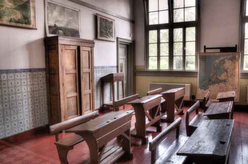
“The local historian will deal with both written and unwritten sources. He will be part archeologist, and part geographer, since a writer mus explain how the land, the soil of the locality, was mastered to human purposes. He will go further, much further, for he must understand and he must know the character of the land so that he may explain and interpret the effects of human actions on the landscape. Certainly he must be aware of, and know the shy of, water courses, trails, roads and fields.

The local historian will be, in part, an economic historian, because the greater part of a man’s life is spent gaining a livelihood – but at the same time he will be an historian of art, and education, and religion- because man does not live by bread alone. He will need to be a modernist because he will need to appreciate the impact on a local community of rail and motor transport – and the social and economic effects of the abandonment of a major form of transport. Certainly he must know sociology since he is attempting to reconstruct social life and society in the earlier days of the local community.” (Archer, 1979)

Population growth has increased, and declined throughout the evolution of the region. The adaptation to a common language facilitated cooperation and economic survival. Hunting and gathering gave way to domestic livestock, and agricultural pursuits. Doukhobors, Mennonites, German Catholics were a few of the ethnic groups who chose to establish farm villages, and settle in a nuclear group with the government waiving the rural survey settlement scheme. Rural settlement on homesteads was a method to disperse the immigrants, avoiding the overcrowding and overpopulation of Europe. How did the patterns of rural pioneer settlement arise, and why did urban settlements first appear? Why has the population shifted, with people moving from one location to another? What are the consequences?

The first nations of the plains have had a rich history in this area. Nakota of the late 1600s were displaced by Cree from the north east, and Assiniboine from the south east over the 1600s. Saulteaux made inroads during the 1700s from the east, however settled further east near the Manitoba-Saskatchewan border by the time the treaties were signed. The Plains Cree made residence in the Saskatoon Gen Web region during the 1800s, were joined by Métis in the mid 1800s

Early fur trade journeys down the South Saskatchewan River were made by Joseph Smith 1763-1764 and William Pink 1766-1767. Matthew Cocking explored a route through the northern portion of the Saskatoon Gen Web Region 1772-1773. The grand majority of fur trading posts were located north of the “tree line” and north of the Aspen Parkland of the Saskatoon Gen Web Region. That being said, Edge of the Woods Hudson Bay Company Post was established about 1863 south of the present day City of Saskatoon, and Moose Woods trading HBC south of Edge of the Woods post had a brief lifespan 1858/1863 and again revived 1874.

The John Palliser Expedition came down the South Saskatchewan River 1857-1859 taking in data of the lad between the Rocky mountains and the Assiniboine River. Henry Youle Hind also made the route in 1858 down the South Saskatchewan River, as did William F. Butler 1870-1871. John Macoun in 1875, and again in 1879 traversed across land crossing the South Saskatchewan River.

Henry Budd founded Carlton House Church of England Mission at Fort Carlton in 1862. On the other side of the South Saskatchewan River, the Roman Catholic Mission was established in about the same vicinity.

All the British colonies of Canada, provinces and territories were united in the Canadian Confederation on July 1, 1867. To include British Columbia into confederation, an inter-colony railroad would improve communication and transportation in general between the settlements of eastern Canada, those communities of British Columbia. To make the railroad economically viable, pressures arose to expand the population across the prairies to improve trade.

Rupert’s Land, or Prince Rupert’s Land, was a territory in British North America comprising the Hudson Bay drainage basin. This land was operated by the Hudson’s Bay Company for 200 years from 1670 to 1870. Rupert’s Land was transferred to Canada in 1869, but the transfer was only consummated in 1870 when £300,000 was paid to the Hudson’s Bay Company.

The Government of Canada passed the Dominion Lands Act of 1872 creating the opportunity for settlers in the Last Best West.

The creation of the Department of the Interior in 1873 had a mission to attract settlers to Canada, creating a strong agricultural economy out west. Settlers were pulled to the area with strong motivations of a better life, and were pushed out of their homelands because of restrictions, over-populations, and under-employment.

David Laird becomes the first Lieutenant Governor of the North West Territories in 1875.

Central and west central First Nations bands signed Treaty 6 in 1876 at Fort Carlton, and again at Fort Pitt later.

Saskatoon Gen Web Map Northwest Territories 1900

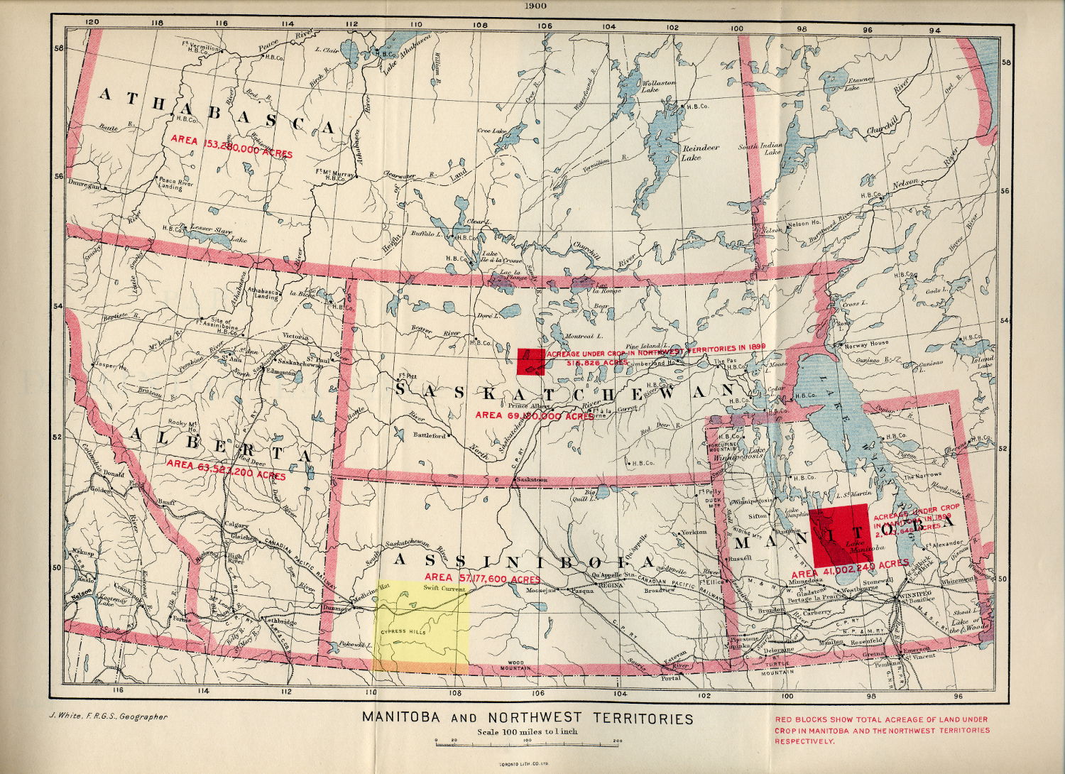
Saskatoon Gen Web Region in green NWT 1900 map Adapted from: “White, James. Manitoba and Northwest Territories [map]. 1:950,400. [Ottawa]: Dept. of the Interior, 1900. Red blocks show total acreage of land under crop in Manitoba and the Northwest Territories respectively. Shows size, in acres the areas of Athabasca, Alberta, Saskatchewan, Assiniboia and Manitoba in 1900. Source: University of Manitoba : Elizabeth Dafoe Library : Map Collection ” Creative Commons Attribution 2.0 Generic

December 23, 1881 the Dominion Government passed regulations allowing colonization companies to be created. These companies would be eligible for odd-numbered sections 24 miles north of the CPR at $2.00 per acre under the pre-requisite that two settlers were residing upon each odd and even section within five years. Colonization companies which could earn the maximum rebate may pay as little as #1.00 an acre, and sell land for $3 to $15 an acre once the colony’s even numbered sections were settled. Besides the Temperance Colonization Society with 213,760 acres, H.D. Smith 10,240 acres and P. Valin 32,900 acres were business applicants in the Saskatoon Gen Web region.

Districts of Assiniboia, Athabasca, Saskatchewan and Alberta are created in the North West Territories in 1882. (The Saskatoon Gen Web Region straddles the Districts of Assiniboia and Saskatchewan)

Though the transcontinental Canadian Pacific Railway went through southern Canada, rail service did not extend north until 1885 when the Qu’Appelle Long Lake and Saskatchewan Railway and Steamboat Co. (QLLS) ran a line between Regina and the south end of Long Lake (Last Mountain Lake). Entrepreneurs using the spring and summer months for construction had plans to use the rail to transport people and goods to Long Lake, and then steamboat for a great length, with another rail line extending from the north end of the lake to Saskatoon and Prince Albert. However, the prairie winters, soon showed the impracticality of using steam paddle ship on a frozen lake. Steamships did operate on Long Lake until the first world war 1914-1918.

1884-1885 see the rising of the Métis and the Northwest Rebellion; post-Confederation Canada’s first naval battle. Gabriel Dumont rides to the United States of America to convince Louis Riel to return to Canada. Louis Riel was the leader of the Métis and was elected to a provisional government in 1869 before the Red River Rebellion and as Provencher, Manitoba Member of Parliament. “Saturday March 28, 1885. …This morning’s paper has startling news, received over night, by wire from Winnipeg. A clash, it is stated has taken place between Riel’s followers and a small force of Mounted Police and civilians, under Major Crozier, at a place called Duck Lake, in which ten civilians and two Police, are reported killed: that the force, being outnumbered, was compelled to retire…The cause of the trouble, so it is said, arose from a grievance of some standing, over Squatter’s rights, wherein early settlers found their lands taken over their heads, by new comers, armed with deeds of possession, obtained through influence at head-quarters. Be that as it may, not since the days of the Fenian Raid, has the country been so stirred over the calamitous news, and the dread of a possible Indian uprising, [is] coupled with the necessity of a prompt solution of the difficulties of transporting troops, and supplies, over such a great distance through unsettled parts.” Archer, 1962) The battle sites of Fort Carlton, Duck Lake, St. Laurent, Batoche, and Fish Creek are within the Saskatoon Gen Web region, as is Saskatoon’s Marr Residence, [National Historic Site] a field hospital to treat Major General Frederick Middleton’s wounded soldiers during the resistance.

Louis Riel was sentenced to hang by the neck until dead following his trial for high treason in Regina. W.G. Books a juror from Indian Head reported to E.R. Powell; “We were asked to declare the man insane. He seemed to us no more insane than any of the others who addressed us, and they were the ablest in all Canada, and he was more interesting and effective than some of them. We could not declare him insane. We were in a dilemma. We were in sympathy with the Métis, knowing that they had good cause for much they did. We often remarked that we would like to have the Minister of Interior in the prisoner’s box charged with inciting the Métis by his gross neglect and indifference…. but we could not pass judgment of the Minister of the Interior, and we had to give our finding on Riel according to the evidence…..

” ‘This man is in a bad hole. What can we do to help him out?’ That was the concern of all of us. There was no division or dissension of any kind. The only thing we could do was to add a clause to the verdict, recommending mercy. We knew it was not much, but it was not an empty formal expression, and it revealed the serious desire of everyone [on the jury].”(Powell, 1967)

“In 1870, Canada negotiated with the Métis. It granted to the Métis of Manitoba 1,400,000 acres of land out of nearly 9,500,000 acres, constituting less than a sixth but more than a seventh of the province as it then existed…the federal Government gave us an assurance that all future treaties with the Métis of the NorthWest would be similar to the Manitoba treaty,” wrote Louis Riel in a letter to Bishop Taché July 24, 1885.(Flangan, 1974)

“The outbreak of the Northwest Rebellion and the crippling effects it had on immigration to the Canadian West compelled the government to recognized the plight of the colonization companies.” The Minister of the Interior, David L. Macpherson wrote to Prime Minister Macdonald; ” The collapse of the boom did much to defeat their efforts, and the outbreak of the Half-breeds and Indians completed that work.”(Lalonde, 1971)

Scrip was proferred to Métis families as a means of compensation following the 1885 Resistance. Notes in the form of money scrip ( $160 or $240) or land scrip, 160 acres (65 ha) or 240 acres (97 ha) were exchanged for aboriginal rights. “In the North-West Territories, the Métis shared only in a very small way the benefits by which the Government finally gave satisfaction to claims of which it had so long remained unaware. The Commission that was established on March 31, 1885, applied there the same principles as in Manitoba. To Métis children born before July 15, 1870, was given the choice between a “scrip” valued at $240, which they could either negotiate or use for the purchase of federal lands, and a “land scrip” which authorized them to pick out a piece of property of 240 acres on unoccupied Dominion Lands. The “heads of families” could also choose between these two kinds of scrips, but their respective values were limited to $160 or 160 acres. In 1900, an Order in Council extended the same benefits to children born between July 15, 1870 and the year 18/85. In this way the Government settled, in the interests of the Métis , the question of “the extinction of the Indian title” It admitted their indigenous status, and recognized for them a privileged treatment in the administration of Indian lands. Those who were already in possession of a land plot were issued patents which guaranteed them outright ownership up to the amount of 240 acres for the children, and 160 acres for the heads of families.” (Giraud, 1956)

1885 saw the establishment of a North West Mounted Police Post at Carlton. This was followed by posts at Batoche, Saskatoon, Henrietta, Sixty Mile Bush [near Biggar], Macfarllane’s and Rosthern. Following the completion of the Canadian Pacific Railway of this year, “importance was now attached to those police duties which increased the comfort and security of the settler’ who was unaccustomed to the pioneer life and required not only information but also assistance, even to find stray animals. The police often provided relief to destitute farmers or those overcome by winter conditions…the police often encountered immigrants as early as their first disembarkment from the train: the police would even sometimes drive them ‘over the most desirable districts for settlement’ providing not only transport, but also cooking utensils, and giving advice and information”. (Betke, 1974)

The years 1885-1890 featured early frost and drought in the weather, settlers abandoned agricultural crops in favour of raising cattle. A financial depression during this period meant difficulties for all.

Trails, such as the “Old Bone Trail” leading into Saskatoon were full of Red River Carts, and Métis carting buffalo bones to the rails where they would be transported to plants converting bones to fertilizer. The years 1890-1891 saw the end of the massive roaming herds of Buffalo across the plains, replaced by cord-wood stacks of their bones alongside the railway track awaiting shipment.

In 1889, the ferry was supplemented by a bridge across the South Saskatchewan River at Saskatoon. The QLLS completed the north-south rail land route in 1890 as far as Saskatoon and Rosthern.

Province of Saskatchewan showing Saskatoon Gen Web Region in Green. Adapted from Author Hwy43 Creative Commons Attribution 3.0 Unported license.

Province of Saskatchewan showing Saskatoon Gen Web Region in Green. Adapted from Author Hwy43 Creative Commons Attribution 3.0 Unported license.

September 1905, Saskatchewan and Alberta both become provinces of Canada.

The Grand Trunk Pacific Railway east-west line was completed about 1908, with a bridge over the South Saskatchewan River at Saskatoon.

1907 Saskatoon, formed as a city in 1904, is chosen as the provincial site for the new University of Saskatchewan, with classes starting in 1908. The Regina Leader-Post wrote following the vote, “Success to the University of Saskatchewan and the University City of the Province, May the [citizens of Saskatoon] rise to the opportunity which now is theirs and create a city…worthy of the great institution which will be located in [their] midst.” (Murray, 1959) Delegates and officials from Indian Head, Qu’Appelle, Battleford, Moose Jaw, Regina, Saskatoon and Prince Albert all presented their case to the Board of Governors convening under Walter Murray of Dalhousie University, Halifax, the new President of the University.

Saskatoon’s boom years were 1910-1912

Seager Wheeler, a Rosthern area farmer wins world wheat championship with his “Marquis Wheat” entry.

“The prairie West had experienced cycles of drought and plentiful rainfall in a more or less normal patter. It was expected in 1930, and in 1932, that this pattern would recur and that “next year” would bring normal moisture conditions…In much of Canada the 1930s was the Depression, but in Saskatchewan it was the ‘Dirty Thirties’ All the problems of drought, insect pests, erosion, low prices for produce, and high winds occurred simultaneously and continued year after year.” (Archer, 1980) Farmers moved north to the tree line, or made a mass exodus to the cities in search of employment, and money for sustenance.


Ethnic Bloc Settlements

Francophone Métis settlements arose around la Pointe-du-Chien-Maigre [Fort Carlton], Lac-aux-Canards [Duck Lake, la Petite-Ville, la Coulee des Touronds [Fish Creek], Batoche, St-Laurent-Grandin between 1866-1876. This settlement expanded around Duck Lake, St.-Isidore-de-Bellevue, St-Louis, and Domremy 1881-1912.

Temperance Colony [Toronto Methodists] was a British Ethnic Bloc Settlement founded 1882 establishing the roots of Saskatoon.

“The steppes of eastern Europe were the ancestral homeland for several groups whose desire to find a secure place to develop their agricultural ambitions, to practice their religion, and to live in peace with their neighbours led them to Saskatchewan. Five distinct cultural groups came to this province from the broad arc of the European continent lying between the Wisla and the Volga rivers, most of which is part of the Ukraine today….the Ukrainians, south Russian Germans, Mennonites, Hutterites, and Doukhobors shared a common homeland…Immigration officers recorded them on arrival variously as Austrians, Russians, Poles, Ruthenians, Galicians, Bukovynians, Volhynians, or Besssarabians – never as Ukrainians” (Barry, 2001)

Saskatchewan Valley Mennonites settled north of Saskatoon between 1891-1918. Laird, Waldheim, Hepburn, Dalmeny, Rosthern, Hague, and Osler. The first families arriving in Rosthern from Manitoba. Rosthern, until 1950 was the Mennonite centre of Saskatchewan. dThe Hague-Osler Mennonite reserved included the Mennonite villages of Blumenheim “Flower Home”, Blumenhoff “Yard full of flowers”, Blumenort “Place of Flowers”, Blumenthal “Garden of Eden Town”, Freundrussendarp “Five Russian Villages, or Five Roses”, Gruenfeld “Green Field”, Gruenthal “Green valley”, Halbstadt “Half Village”, Hochfeld “High Field”, Hochstadt “HIgh Place”, krim, Kronsthal “Crown Valley”, Mennon, Neuanlage “New Settlement”, Neuhorst “New Grove of Trees”, Olgafield, Ostwerwick “East berm or dam”, Reinland “Clean Field”, Rieferthal “River valley”, Reinfeld “Clean field”, Rosenback “Rose Brook”, Rosenfeld “Field of Roses”, Rosengart “Rose Garden”, Rosenort “Place of Roses”, Salem, Schlauberg “Overall Hill”, Schlorrendarp “slipper Village”, Schoenfeld”Beautiful Field”, Schoenthal “Beautiful Valley”, Schoenwiese “Beautiful Meadow”, Silberfeldt “Silver Field”, Steinreich “rich with stones”, Suedflus, “South River”,.

An 1894 migration of Croatians settled near Hanley.

The Redberry Lake and Albertown Polish concentration immigrated in 1896 south east of Battleford around Blaine Lake, Marcelin, and Krydor.

Prud’homme settled 1897 by 260 French settlers was originally known as Marcotte Ranch in 1897, Lally Siding 1904 and Howell in 1906, until receiving the name Prud’homme in 1922..

In 1898, a Ukrainian settlement at Fish Creek mixed with Polish settlers that same year, the St. Laszlo Hungarian settlers who arrived between 1900-1905. The Ukrainian bloc settlement [6,000 immigrants]included Fish Creek, Redberry, Crooked Lake [around Wakaw] of the Saskatoon Gen Web Region.

The Meilicke family encouraged settlers to come up from Minnesota and established the area around Dundurn.

Doukhobors arrived 1899-1902 to set up the Prince Albert – Saskatchewan – Blaine Lake Colony [north section.Winnipeg Commissioner of Immigration, W.F. McCreary stated in his December 31, 1899 report that “the first group of 2,078 ‘souls’ arrived January 27, 1899, followed by 1,973 in February; in May, 1,136 came and July saw 2,335.” Betke mentions that Doukhobour immigrants to the North-West Territories began arriving at Winnipeg on January 27, 1899, by September, 7,427 Doukhobors had entered the area. 1,472 of them established themselves on the North Saskatchewan river west of Carlton near Battleford; 1,404 settled in the “Thunder Hill”, or “North” Colony on the border of Manitoba and the Territories, and the largest group, some 4,478, located in the vicinity of Yorkton.”A letter written to McCreary February 9, 1899 described the conditions; The thermometer stood at forty four {below zero, Fahrenheit} Last night, during the fire in the “Manitoba”, it stood about fifty one, and it has been running from thirty-five to forty -five , with a keen wind, for many weeks..These Doukhobors have hard leather boots with a piece of blanket about the foot, and no socks. The women also, have only a half slipper with leather soles. They have not mitts whatever, or, at least, very few, so that the work of getting them out to the colonies has been stationary.”(Ward, 1981)

“The police found much to admire in the Doukhobor pioneer operations. They showed unique skills in breaking horses, constructing ovens of “home-made sun-dried bricks” and building clean and sturdy though dark houses and stables of sod, mud and logs. They were orderly, quiet , well organized, ‘patient, industrious and self-supporting’: the women proved equal to the men in strength and skill at manual labour and attended to household duties besides.”(Betke, 1974) Doukhobors placed claims for communal land exemption from land tenure registration, and exemption from birth, death, and marriage registration.

In the north east of Saskatoon Gen Web is the St. Peter’s Colony, hosting American German arrivals between 1902-1914. Annaheim, Bruno, Carmel, Cudworth, Englefeld, Fulda, Humboldt, Lake Lenore, Marysburg, Middle Lake, Muenster, Pilger, st. Benedict, St. Gregor, and Wakaw all have a high German Catholic population, as the Russland Deutsche, or German Catholic settlers arrived from Minnesota via the German American American Land Company around Muenster.

In the Allan HIlls, around Lothian came a Scottish bloc settlement in 1902.

1903 saw the arrival of Norwegians around Hanley, Outlook and Elbow areas.

St. Brieux saw the rise of a French settlement of around 367 settlers around 1904-1909, Dollard, Vonda and Wakaw were other French settlements in the region.

Young saw Irish arrivals in 1904, Sinnett in 1906, and Simpson in 1912.

South of Humboldt came Mennonite settlers to form the Guernsey and Nortstern – Drake colonies 1905-1913. In 1908, the Plunkett area saw an Hungarian settlement, Pinkefalva in 1908.

Redberry Lake Ukrainian bloc settlement arrived 1904-1914 south east of Battleford.

South east of Saskatoon the St. Aloysius, Allan German Bloc settlement arrived 1903-1907

In 1924, the Nordheim, Hanley, Dundurn area Mennonite settlers arrived 1924 south of Saskatoon.

Riverview Hutterite colony 16 families population 90 was established 1956, Hillcrest 10 families population 50 1969, Willow Park 1977, Golden View 1978, Rosetown 1979, Big Rose 1980, Eagle Creek 1981


Cities.

Martensville founded 1939 Became village September 1, 1966 Incorporated Town January 1, 1969, Incorporation Date City November 3, 2009

Saskatoon founded 1883, Became village November 16, 1901 Incorporated as Town July 1, 1903, Incorporation Date City May 26, 1906

Warman founded 1904, Became village May 15, 1905, the same day incorporated as Town, Incorporation Date city October 27, 2012.

Note:  The new Saskatoon Gen Web is online at https://saskatoongenweb.site123.me/ while the original Saskatchewan Gen Web  site is under maintenance by Ancestry/Rootsweb.com.  Check periodically for progress on the historical site http://www.rootsweb.ancestry.com/~sksaskat While waiting please check out https://saskatoongenweb.site123.me/

The new provincial Saskatchewan Region Gen Web is online at https://saskgenweb.site123.me the original Saskatchewan Region Gen Web site is under maintenance by Ancestry/Rootsweb.com. Check periodically for progress on the historical site waiting http://www.rootsweb.ancestry.com/~cansk in the meanwhile please check out https://saskgenweb.site123.me/

Bibliography:

Archer, John H. Saskatchewan A History. Western Producer Prairie Books. ISBN 0-88833-6 bd, ISBN 0-88833-2 pa. Saskatchewan Archives Board. 1980

Archer, John H. North-West Rebellion 1885. Recollections, Reflections and Items, from the Diary of Captain (no Lt. Col.) A. Hamlyn Todd who commanded the Guards Company of Sharpshooters on that Expedition. Saskatchewan History. Volume XV. Winter 1962. Number 1.

Archer, J.H. “Local History” Local Archives and History Conference Proceedings. Regina, Saskatchewan Archives Board, 1979. Page 11

Barry, Bill. Ukrainian People Places. Ukrainians, Germans, Mennonites, Hutterites, and Doukhobors, and the names they brought to Saskatchewan. People Places Publishing Ltd. ISBN 1-894022-65-3. 2001.

Betke, Carl. The Mounted Police and the Doukhobors in Saskatchewan, 1899-1909. Pages 1-14 Saskatchewan History Volume XXVii Winter 1974. Number 1.

Bitner, Ruth and Leslee Newman. Saskatchewan History Centennial Timeline, 1905-2005. Saskatchewan Western Development Museum. Saskatchewan Archives Board. ISBN 0-9697014-5-4. 2005.

Daschuk, J.W. , Paul Hackett, Scott MacNeil. Treaties and Tuberculosis: First Nations People in late 19th Century Western Canada, a Political and Economic Transformation. CBMH/BCHM Volume 23:2 2006 Pages 307-330

Flanagan, Thomas E. Louis Riel’s Religious Beliefs. A letter to Bishop Taché. Saskatchewan History. Volume XXVII. Winter 1974. Number 1.

Fung, Ka-iu. Atlas of Saskatchewan Celebrating the Millenium 2000-2005. University of Saskatchewan Second Edition. ISBN 0-88880-387-7. PrintWest Saskatoon. 1999.

Trading Posts. Pre 1759-Post 1930. Page 34, 35
Waiser, Bill. Scientific Explorations 1870-1914. Page 42-43
Barry, Bill. First Nations and Treaties 1871-1906. Page 44-45
Avery, Cheryl and Stan Hanson. North West Mounted Police and the Indians. Page 46-47
Anderson, Alan. Ethnic Bloc Settlements 1850s-1990s Page 56-57
Drees, Laurie Meijer. North Missions 1820-1910. Pages 38-39

Giraud, Marcel. The Western Métis After the Insurrection. Pages 1-15. Saskatchewan History. Volume IX. Winter 1956, Number 1.

Lalonde, A.N. Colonization Companies in the 1800’s. Page 101-114. Saskatchewan History Volume XXIV Autumn 1971. Number 3. Saskatchewan Archives Board.

Murray, Jean E. The Contest for the University of Saskatchewan. Pages 1-22. Saskatchewan History. Volume Xii, Winter 1959, Number 1.

Norton, William. Human Geography Sixth Edition. Oxford University Press. ISBN 978-0-19-542511-6. 2007.

Pohorecky, Zenon. Saskatchewan People A brief illustrated guide to their Ethnocultures. Second Enlarged Edition. 1977 Saskatoon. Saskatchewan Association on Human Rights, Canadian Department of the Secretary of State, and the Saskatchewan Department of Culture and Youth.

Powell, E.R. Louis Riel’s Request to the Jury. Canadian Federation of the Blind Magazine. c1967

Richards, J.H. and K.I. Fung. Group Settlements. Atlas of Saskatchewan. University of Saskatchewan. Modern Press. Saskatoon. Page 13. 1969.

Ward, Betty. Trek of the Doukhobors. Page 17-24. Saskatchewan History Winter 1981. Volume XXXIV. Number 1. Saskatchewan Archives Board.

Note The new Saskatoon Gen Web is online at https://saskatoongenweb.site123.me/ while the original Saskatchewan Gen Web site is under maintenance by Ancestry/Rootsweb.com. Check periodically for progress on the historical site http://www.rootsweb.ancestry.com/~sksaskat While waiting please check out https://saskatoongenweb.site123.me/

The new Saskatchewan Region Gen Web is online at https://saskgenweb.site123.me the original Saskatchewan Region Gen Web site is under maintenance by Ancestry/Rootsweb.com. Check periodically for progress on the historical site at http://www.rootsweb.ancestry.com/~cansk while waiting please check out https://saskgenweb.site123.me/

Maps and the lost Placename

5 Nov
Old Newspaper article National Railways Western Lines Map depicting Port Arthur / Fort William and Churchill to Prince Rupert and Vancouver Island. BC, Alberta, Saskatchewan, Manitoba, Ontario Larry Walton

Old Newspaper article National Railways Western Lines Map depicting Port Arthur / Fort William and Churchill to Prince Rupert and Vancouver Island. BC, Alberta, Saskatchewan, Manitoba, Ontario Larry Walton

“In cartography, as in medicine, art and science are inseparable. The perfect map blends art and science into an effective tool of visual communication.” ~ Dr. Keith Harries

How to travel to a homestead or unofficial placename in Saskatchewan or Western Canada.

How to determine distances between contemporary placenames and ghost towns.

Do you have an historic document or correspondence which has a placename that you have not heard of previously?

The homestead or locality which does not appear on a modern map are an enigma to the traveller trying to find the ancestral home. The genealogical researcher may wish to locate a local history book, or cemetery to glean more information about their family tree, however where would one locate the Saskatchewan place name “End Lake” or “Roderickville” for instance?

One very excellent resource is Geographical names in Canada | Natural Resources Canada Looking up a placename for any locale in Canada will produce the latitude and longitude along with a map, legal land description along with nearby placenames and the distance from the longitude / latitude supplied or the distance from the placename searched.

Another is the Online Historical Map Digitization Project showing maps, atlases and gazetteers from 1862 to the mid 1950s, genealogists and historians can find a variety of maps are a valuable reference tool for information about places, place names and their locations.

Old Newspaper article National Railways Western Lines Map British Columbia, Alberta, Saskatchewan Manitoba, Ontario.  By Larry Walton

Old Newspaper article National Railways Western Lines Map British Columbia, Alberta, Saskatchewan Manitoba, Ontario. By Larry Walton

In Saskatchewan, take the initiative to also check the two Atlas of Saskatchewan books along with Bill Barry’s Geographic Names of Saskatchewan for placenames and their locations book ISBN1-897020-19-2. Saskatchewan local history directory : a locality guide to community and church histories in the Prairie History Room, Our Towns: Saskatchewan Communities from Abbey to Zenon Park By David McLennan and Saskatchewan Ghost Towns are other major resources to help you on your way with your preliminary research online. Search Saskatchewan Placenames amalgmates placenames from the National Archives resources, various books and atlases, and historical maps.

An historical location may be defined by the legal land location. How easy is it to locate Roderickville located at section 20 township 15 range 10 West of the third meridian?

“A map is the greatest of all epic poems. Its lines and colors show the realization of great dreams.” ~ Gilbert H. Grosvenor

Roderickville appears on Larry Walton’s Canadian National Railways Western Lines Map a part of the Online Historical Map Digitization Project and Roderickville also shows up in Geographic Names of Saskatchewan. It then becomes apparent that Roderickville is located just west and south of Swift Current near Rush Lake on the Canadian National Railway. Travelling to Roderickville, now becomes much easier with such bearings.

Obtaining a modern Rural Municipality map then provides current roads for the area. The determination of which Rural Municipality needs to be contacted can be derived from one of these maps which will help locate the legal land description, in this case section 20 township 15 range 10 West of the third meridian for Roderickville. This legal land location can be identified by

Rural Municipality Coulee No. 136
Latitude Longitude
50.273554 -107.345313
50° 16.413′ N 107° 20.719′ W
50° 16′ 24.79″ N 107° 20′ 43.13″ W
Township Road 154 Range Road 3105
MGRS/USNG UTM NTS
13U CR 32882 71677
13N 332882 5571678 C-28-C/72-J-6

So by entering in the degrees longitude and latitude into Geographical Names of Canada, the determination is made that:

Neighbouring placenames to Roderickville are

  • Braddock 24-13-11-W3 is a nearby Locality 19 kilometers
  • Burnham 16-15-11-W3 is a nearby Locality 9 kilometers
  • Coulee No. 136 is a nearby Rural Municipality 13 kilometers
  • Fauna 16-11-W3 is a nearby Railway Point 16 kilometers
  • Hallonquist 25-13-10-W3 is a nearby Hamlet 19 kilometers
  • Herbert 17-9-W3 is a nearby Town 19 kilometers
  • Neidpath 1-15-10-W3 is a nearby Hamlet l 9 kilometers
  • Rush Lake 1-17-11-W3 is a nearby Village 15 kilometers

By contacting the individual Rural Municipality for their map, driving on township and range grid (gravel) roads becomes very easy to arrive at your destination. Saskatchewan Geographic Perspectives

Do you wish to discover how to travel to an unincorporated hamlet? Pay attention to the road signs as you travel along the country gravel road. There is a pattern to the township and range Roads in Saskatchewan as are assigned by the Saskatchewan Provincial  Standard System of Rural Addressing.

“I am told there are people who do not care for maps, and I find it hard to believe.” ~ Robert Louis Stevenson

The other method to arrive at Roderickville section 20 township 15 range 10 West of the third meridian would be to use an online legal land converter which determines the latitude and longitude and the GPS bearing for any legal land location. Then plug this number into any GPS system.

Ascertaining which localities are close to Roderickville and which Rural Municipality Roderickville is located within, also helps to know which cemeteries are nearby and which local history books are written for the area. Use any library catalogue and type in the rural municipality or larger municipality name. Genealogists may be interested in neighbouring cemeteries to locate an ancestor. In Saskatchewan, a number of the cemeteries are online by a variety of groups, as they are for many countries and provinces across Canada. The Saskatchewan Genealogy Society, for example lists cemeteries by rural municipality.

  • Village population of at least 100
  • Town population of 500 or more
  • City 5,000 residents.

Ghost towns are communities that no longer exist or former Villages/Towns that have become unincorporated hamlets. Delve into some historic maps and placenames which have disappeared from contemporary maps. Before the motorized vehicle was in common use, pioneers and homesteaders relied on horse and cart or ox and buggy for transport to take grain to market, or to drive into town for mail, groceries and supplies. So how far could a horse travel for example? How far a horse travels in one day – Cartographers’ Guild suggests;

Horse / Horse and Cart Travel Distances
Geographic surface
Level or rolling terrain: Without a cart With a loaded cart
On Roads / trails 40 miles/day 64 kilometers/day 20 miles/day 32 kilometers/day
Off-Road (or unkempt trails etc)
Hilly terrain: 30 / 51 15 / 24
Mountainous terrain: 20 / 32 10 / 16
Level/rolling grasslands: 30 / 51 15 / 24
Hilly grasslands: 25 / 40 12 / 19
Level/rolling forest/thick scrub: 20 / 32 10 / 16
Very hilly forest/thick scrub: 15 / 24 7 / 11
Un-blazed Mountain passes: 10 / 16 5 / 8
Marshland: 10 / 16 5 / 8

According to Chapter 7 Settlement Evolution since the Late Nineteenth Century. Saskatchewan Geographic Perspectives by Hansgeorg Schlichtmann and M.L. Lewry, towns “were usually spaced 12 to 15 km apart along a railway line so that, in the age of horse-and-cart traffic, a farmer could make a round trip to town and back in one day. Along GTP lines (e.g. the Regina-Fort Qu’Appelle-Melville line) they were rather more closely spaced and, subsequently, more of them have declined or even disappeared more than towns on other trunk lines.”. Local Improvement Districts (LID’s) and, Statute Labour and Fire (SLF) Districts improve the local community, establishing cemeteries, honouring war dead, providing health care, roads, bridges. The horse and cart were greatly assisted by the work of the early precursors to the RM and to the Department of Highways and the ensuing Rural Municipality formation. LIDs and SLFs were replaced by Rural Municipalites (RM) following the Spencer Commission findings. Roads were straightened in the 1960s following World War II as more families had access to motorized transport with improved technologies from World War II. When the veterans returned home, society made further improvements. These improvements phased out the need for travel by horse, horse and cart, and ox and buggy. Gradually the extensive railway system saw branch lines closing due to the same phenomena. The one room school house gave way to the consolidated school in town. Families shifted away from the rural farm following the drought and depression in the 1930s seeking economic recovery in the urban centres. The consolidated school also attracted younger families to urban centres and away from living a rural existence.

“First, farms became larger and the rural population declined, so that the sales volume of small-town stores decreased and many businesses ceased to be viable. Second, motor vehicles became more affordable and highways were improved, thereby increasing mobility. Third, this mobility, along with greater disposable income, enabled rural people to purchase goods and services available in higher-order, more distant central places. Fourth, to achieve costs savings, many smaller grain elevators, and public service facilities such as schools and hospitals were replaced by larger ones, at fewer locations. …A number of small settlements have disappeared.” Schlichtmann

Good luck on your journey, and have a lot of fun discovering where once there was a thriving and active community of settlers, which may no longer exist. What can be found today? Does the foundation of a store, or a school district flag pole still remain? Here is another mystery; McMichael near Melfort on Larry Walton’s Canadian National Railways Western Lines Map. This placename of McMichael does not appear on contemporary maps, and is not discovered by Bill Barry in his book, so what is known of this placename that has disappeared? Are there any other placenames on historic maps which are not listed at Search Saskatchewan Placenames? Lost places collect placenames without a location, and the Search Saskatchewan Placenames seeks to update its listing with new additions as they are submitted.

Have fun on your genealogical journey discovering what are the neighbouring communities of an ancestral ghost town. By locating a historic settlement it is easier to find resources such as local history books, libraries, museums, historical societies, cemeteries and perhaps a descendant still farming on the “Century Farm” to help discover further information for the family tree. If you are tracking down a historic placename in correspondence or a treasured historic letter, please bear in mind, that pioneers and settlers often referred to their placename where they lived as the name which may be indeed the one rom schoolhouse district as it was an integral part of the new community, and settlers gathered together at the school house for meetings, dances, rallies, the Christmas play etc.

________________________________________________________________________________

Related Posts:

Country Roads Leading Home

Where were Saskatchewan homesteads located?

How do I locate my Ancestors Home Town in Saskatchewan?

Locate Your Saskatchewan Place-name

How did pioneers travel to their prairie homesteads?

Maybe the Ghosts Will Live Again! Saskatchewan Ghost Towns… Do you have oral history about a Saskatchewan placename not on a current map? How do you find those communities which were once dotted around the prairie every six miles or so?

________________________________________________________________________________

All rights reserved. Copyright © Julia Adamson All my images and text are protected under international authors copyright laws and Canadian photography laws and may not be downloaded, reproduced, copied, transmitted or manipulated without my written explicit permission. They may be licensed through Getty images. .. Peace and love be with you.
Namaste.

________________________________________________________________________________

Follow me on Sask Gen Web, 500 px, Word Press, Facebook, Blogger, Twitter, Tumblr, Live Journal, Flickr, and Flickriver

________________________________________________________________________________

Aum_Kleem - View my most interesting photos on Flickriver

________________________________________________________________________________