Tag Archives: Canadian Pacific Railway

Swift Current Gen Web’s Amazing History

8 Jun

Swift Current Gen Web Regions’s Amazing History

What do Chimney Coulee, the great Sandhills, Palliser Triangle, Cypress Hills, Willow Creek, Fort Walsh, ’76 Ranch have in common?  They are evolutionary geographical features of the Swift Current Gen Web Region.  It is with an understanding of this region that researchers will garner an interest into its character, values, institutions, and the way the culture has characterized its peoples.  What is the heritage of the Swift Current Gen Web Region?  History has many tangents, and no single facet can tell the complete story, as the roots come from a wide variety of cultures and experiences.

The Captain John Palliser British North American Exploring Expedition of 1857-1860 defined a triangular area radiating south from Kindersley as basically an extension of the Great North American desert, and encompass the Great Sand Hills of Saskatchewan.  Palliser’s expedition arrived during a cyclical episode of great drought.

The first nations of the plains have had a rich history in this area.  The Snake and Gros Ventres of the 17th century were gradually displaced by the Assiniboine in the 18th century.  The Sioux came up from the United States over the latter half of the 19th century creating settlements.  The small pox epidemic of 1832, which lasted six years, virtually wiped out 31% of the Assiniboine population killing over 4,000 persons.

All the British colonies of Canada, provinces and territories were united in the Canadian Confederation on July 1, 1867.  To include British Columbia into confederation, an inter-colony railroad would improve communication and transportation in general between the settlements of eastern Canada, those communities of British Columbia.  To make the railroad economically viable, pressures arose to expand the population across the prairies to improve trade.

Rupert’s Land, or Prince Rupert’s Land, was a territory in British North America comprising the Hudson Bay drainage basin.  This land was operated by the Hudson’s Bay Company for 200 years from 1670 to 1870.  Rupert’s Land was transferred to Canada in 1869, but the transfer was only consummated in 1870 when £300,000 was paid to the Hudson’s Bay Company.

Le Mont-aux-Cypres / Cypress Hills Metis settlement established a presence in this area 1870.  It was also during this decade, that “consumption” or pulmonary tuberculosis ravaged the population of the indigenous population.

Back in 1871, Isaac Cowie operated a Hudson’s Bay Company post from 1871-1872 trading with the area Metis.  This site  came to be known as Chimney Coulee [now a Provincial Historic Site]. Isaac Cowie stayed only the one winter, taking back with him thousands and thousands of pelts, never to return.   In Saskatchewan, the majority of trading posts were operated near or north of the “tree line” or where settlements Metis or immigrant were established.

The Government of Canada passed the Dominion Lands Act of 1872 creating the opportunity for settlers in the Last Best West.

In the spring of 1873, unknown Natives stole a horse/horses from a small party of Canadian and American wolfers, led by Thomas W. Hardwick and John Evans.  At Fort Benton, Montana Territory, the wolfers pleaded for assistance and justice for the crimes against them, however, help was not forthcoming, and a posse formed from American and Canadian traders.  The posse arrived at Abe Farwell’s trading post.  An altercation broke out between the posse and the Little Soldier Assiniboine camp, though Little Soldier attested that they did not have the missing horse, and offered two of their horses until the missing horse was located.  Shots were fired by the posse, and between thirteen to eighty Assiniboine fell and one trader.  It was during this time period that the North-West Mounted Police (NWMP) were established by Prime Minister Sir John Macdonald to maintain order in the North-West Territories in response to this, the Cypress Hills Massacre. The “March West” across 900 miles (1,400 km) was the government’s attempt at bringing recruits to the west to create a military presence and serve as a safety net for prairie residents. [Clarification Note]

The creation of the Department of the Interior in 1873 had a mission to attract settlers to Canada, creating a strong agricultural economy out west.  Settlers were pulled to the area with strong motivations of a better life, and were pushed out of their homelands because of restrictions, over-populations, and under-employment.

The British North American Boundary Commission surveyed the international boundary along the 49th parallel between Canada and the United States of America between 1873-1874.  Dr. George Mercer Dawson was the geologist-naturalist who reported “prime grazing land” in his investigations along the border survey.

In 1874, thirteen First Nations chiefs signed Treaty Four at Fort Qu’Appelle which covered the land south of the South Saskatchewan River.  Cree, Saulteaux, Nakota are among the contemporary thirty five First Nations encompassed by Treaty Four.

Whatever the cause of prejudice and animosity between the First Nations and the traders, the Cypress Hills Massacre set a precedent for the Dominion Government.  Fort Walsh North West Mounted Police Post [now a National Historic Site of Canada  a was erected 1875 in Cypress Hills.  Additionally NWMP posts were created at Maple Creek, Willow Creek, Ten Mile, Farwell, Eastend, Stone Pile, Snake Creek, and Swift Current in the Swift Current Gen Web Region.  The police regularly patrolled the trails discouraging whisky trading, cattle rustling, overseeing the railway camps, and generally maintaining “law and order”.

David Laird becomes the first Lieutenant Governor  of the North West Territories in 1875.

The Fort Walsh National Historic Site notes that “adhesions to Treaty Four were signed at Fort Walsh in 1877 (Man Who Took The Coat, Long Lodge, and Lean Man)”

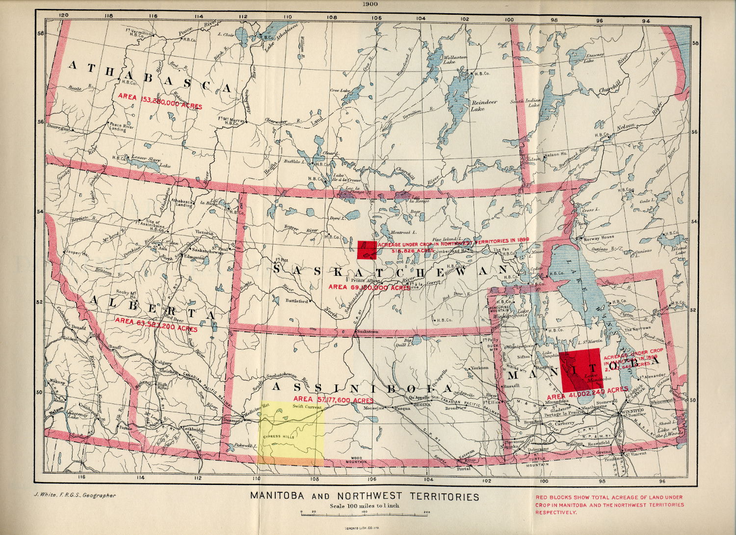
Swift Current Gen Web Region is coloured in Yellow   Adapted from:
“White, James. Manitoba and Northwest Territories [map]. 1:950,400. [Ottawa]: Dept. of the Interior, 1900. Red blocks show total acreage of land under crop in Manitoba and the Northwest Territories respectively.  Shows size, in acres the areas of Athabasca, Alberta, Saskatchewan, Assiniboia and Manitoba in 1900. Source: University of Manitoba : Elizabeth Dafoe Library : Map Collection “Creative Commons Attribution 2.0 Generic

John Macoun, a professor of natural history examined the areas of the South Saskatchewan Rivers in 1879-1880. The weather on the prairies cycles between drought, and extremely wet spring and summers.  Macoun’s wet summer was in direct contrast to the drought experienced by Palliser.  Macoun sent news to the Government surveyors, that the lands between Moose Mountain, and Cypress Hills featured great swaths of green grasses, forecast productive soil for cultivation.

The Buffalo which had previously roamed the plains in great herds were decimated by 1879. The buffalo were gone, the main source of sustenance for the First Nation’s PeopleThe Canadian Government facilitated large scale farming and ranching prior to the homestead settlement of the “Last Best West.”  The Dominion Governments policy regarding ranching, and grazing land evolved considerably between 1870-1930.  Basically any lands unfit for crop production, and could not be used for homestead settlement, would be recommended for grazing lands.  Grazing leases were established for up to 12,000 acres of land.  Cattle are the major ranch animals, supplying beef on demand.  Ranches generally speaking were a large scale affairs, because low productivity is involved.  They require large areas of land with low population density.

Edgar Dewdney is appointed by Prime Minister MacDonald as the new Indian Commissioner, and arrives at Fort Walsh 1879.  In 1880 over 5,000 Indians come to Fort Walsh on treaty day seeking assistance as they are starving.  Dewdney forced all the First Nations to leave Fort Walsh in October of 1882, starving as they were, and travel back to their reserves for their  annuities.  MacDonald himself traveled to Fort Walsh in November 1882 to make treaty payments. Maureen Katherine Lux quotes MacDonald; “I know they are not getting enough flour but I like to punish them a little.  I will have to increase their rations, but not much.”  With such treatment, those First Nations who had held out, and not signed treaties were forced to submit, as their people were so hungry and weak.  Throughout this decade, First Nations people died from Whooping Cough, tuberculosis, and starvation.

Though the country of Canada first envisioned a northern route for the transcontinental railway through Prince Albert, the agricultural promises provided by Professor Macoun coupled with the threat of an American invasion, changed the laying of the rail.  The 1881 contract given the Canadian Pacific Railway Company saw the rail extend from the province of Manitoba and reach Swift Current by 1882.   This railway, the Canadian Pacific Railway created the first transcontinental railway, and served as an impetus to bring settlement and development across the plains.

The District of Assiniboia, North West Territories, was  created in 1882 as a regional administrative district of Canada’s North-West Territories.

The province of Saskatchewan was created in September of 1905.

Rangeland, Cattle Companies and Ranches.

A Scotchman by the name Sir Lister Kay arrived in the 1870s, one of the first ranchers who to the area, ranching between Swift Current and Medicine Hat NWT, a rangeland of about 150 miles. Kay had about 30,000 sheep and several thousand cattle. The “76” Ranch at Crane Lake owned by the Lister Kaye Co. and under the management of a great cattleman, D.H. Andrews, was one of the most profitable and successful ranches according to notes of the Saskatchewan Historical Society. The “76” Ranch at Crane Lake was then operated by the Canadian Land and Ranch Co. with their headquarters at Crane Lake which Kay had left behind.  No discussion of the Saskatchewan Range would be complete without mentioning the Empire Cattle Company, and T Bar Down and the Conrad Price major ranches.

Simon Evans [Atlas of Saskatchewan] reports that “the number of beef cattle in Saskatchewan rose from 212,145 in 1901to 360,236 in 1906, …the number of beef cattle in the province rose from 360,000 to almost 900,000 between 1906 and 1921…and peaked at 453,606 in 1919.”

To recall the “Round Ups” of the early twentieth century, Mr Harry Otterson, range manager of the Bloom Cattle Company recalls a round-up of 1904.  “The range business has passed through some marked changes in the Cypress Hills the past thirty-five years.  The vast territory lying between the C.P.R. railway and the Milk River in Montana was an empire of grass and water, where cattle roamed at will.  The round-up outfits reached far from the home ranch during the summer to gather the straying cattle and return them to their range.  …The trailing of sheep in great numbers, between the Milk River, and the Canadian line was fast destroying the range for cattle, and Montana cattle were moving into Canada in increasing numbers, partly on account of the splendid range found there, but largely on account of the vast trek of shepherds across their home range.  During the late summer of 1904 there were several disastrous prairie fires along the Canadian border and the greater part of the range was burned, from Battle Creek east to the Frenchman River, north of Saco, Montana. “~Maple Creek News 1939  The Bloom Cattle Co. located at T Bar Down Ranch Herds of the Bloom Cattle co ranged in size from 3,700 head of cattle  to fifteen thousand steers. ~ The Eastend Enterprise March 24, 1938  The Turkey Track Ranch was located to the east, and the “76” range to the north.   The Oxarat Horse Ranch near Fort Walsh was the oldest and largest horse ranch  of the country in the early 1880s.

Ranching was not without perils and the miles of grassland gutted by enormous raging grass fires has already been mentioned in 1904 resulting in scarcity for the cattle feed.  Another peril came for the Turkey Track Ranch under Messrs. Cresswell and Day which set up during the summer of 1903, and they were hit by the worst winter on record for cattle.  Deep snow falls alternated with frost, seizing up the cattle, resulting in a loss of over 8,000 head of cattle.  Generally speaking cattle could fend for themselves over the winter months, however the winter of 1906-1907 also took thousands of cattle caught up in the great northwest blizzards.  The Canadian Pacific Railway fenced off their rail grade, and cattle, pressed forward by the northwesterly winds were caught on the CPR fence wires, and perished.  The larger ranch outfits who had a rider traveling with the herds could cut the CPR fence, and let the cattle through to open wind swept lands, and coulees for protection from the fierce wind, fared better during this severe winter.  Those cattle outfits which were smaller and without a rider lost as many as 90% of their herds.

Miriam Green Ellis recalls that, “apart from the fur trade, ranching is the oldest business in Western Canada.  The ranchers came on the heels of the buffalo, and established themselves in pretty much the same locale, which was natural.  They figured that if the grass could feed buffalo the year round, it should be able to feed cattle, sheep and horses.  The grass in this area cures on the ground and in the old days the stock never got anything else, nor had they any winter shelter except the coulees. ”  It was in 1912 that the “lease system” required that the rancher had to reside on the land of his lease, and the open range for cattle grazing became a thing of the past.  In the declining years of the Saskatchewan rangelands, Robert Cruikshank kept the Rush Lake Ranch going, Gordon Ironside and Fares operated the Crane Lake Ranches, Gilchrist Brothers owned the largest cattle herd of South Western Saskatchewan by 1938.  The June 13, 1944 edition of the Leader Post noted that cattle numbers were reaching the capacity of the rangeland.  About 100 stockmen and ranchers owned around 90,000 head of cattle, and sheep.

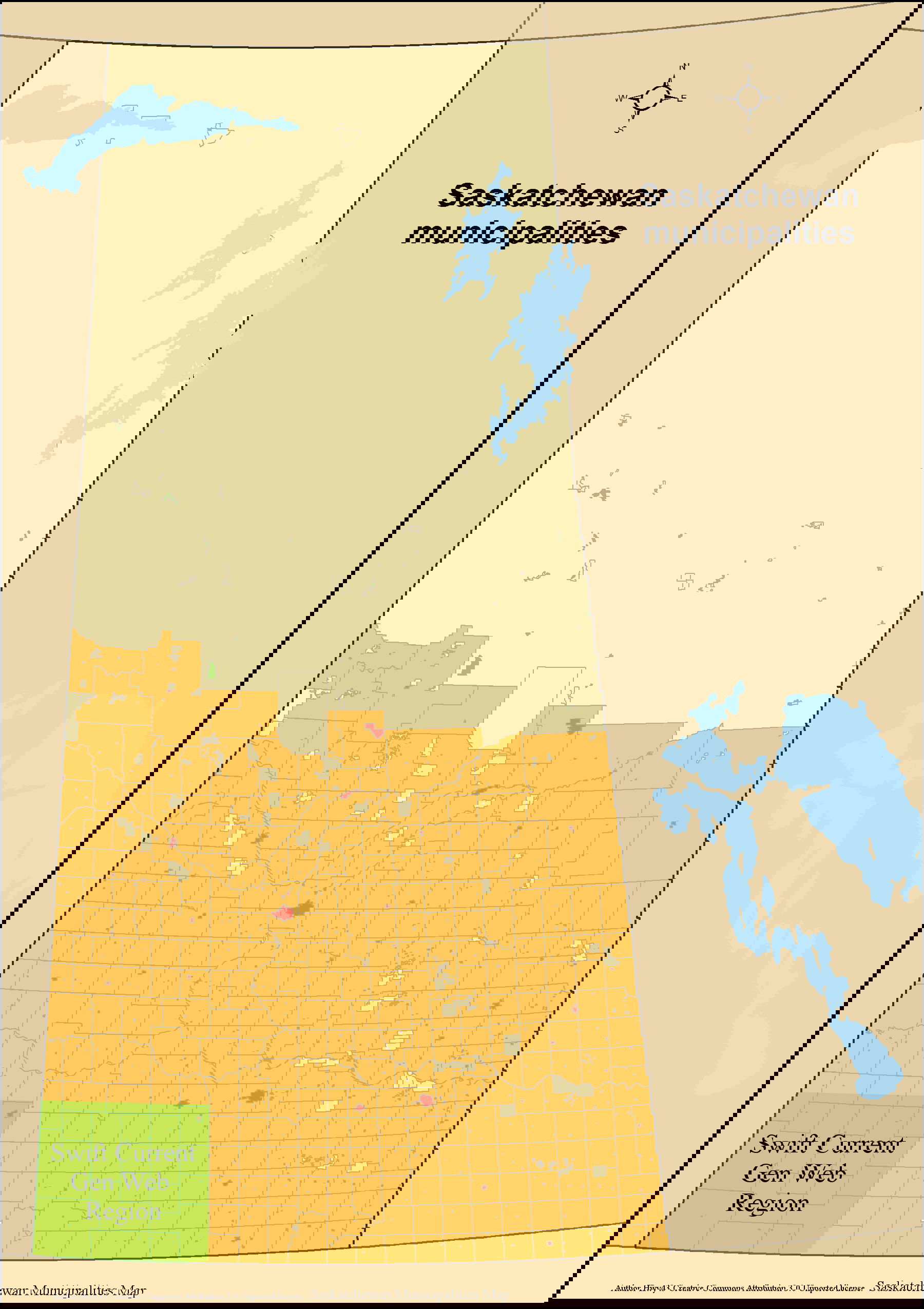
Swift Current Gen Web Region [green] in the Province of Saskatchewan Adapted from Author Hwy43 Creative Commons Attribution 3.0 Unported license.

Ethnic Bloc Settlements

Lac Pelletier in 1907, Dollard and Val Marie in 1910 were a few of the French settlements in the region.  Shaunavon received Irish settlers, and Webb the Welsh.  Belgian settlers were attracted to Swift Current as were the Dutch immigrants.

A large Norwegian Ethnic Bloc Settlement arose around Climax and Robsart in 1911 along the USA and Canada border, and extended north for some 12 to 24 miles and extended east and west 60 miles. Swedish settlers arrived to Admiral and Shaunavon, often working at the Canadian Pacific Railway to earn cash in order to prove up their homesteads.

A German group settlement arrived to the area round the Vermillion Hills, Herbert, Excelsior, Swift Current and Coulee.  In the 1920s Russian and American German concentrations of immigrants were found in southwestern Saskatchewan around Eastend, and Consul areas.

Hutterites migrated from the U.S.A. to Alberta and Manitoba around 1918.  The migration from Alberta to Saskatchewan bean in 1952 when lasws in Alberta changed.

  • Bench (Lehrer) near Shaunavon 1956. 1,200 acres for 13 families; 72 people
  • Tompkins (lehrer) near Tompkins 1956. 8,800 acres dfor 12 families; 71 people
  • Spring Creek (Darius) near Walsh 1958. 14,369 acres for 14 families; 69 people
  • West Bench Hutterite Colony  near Eastend 1960. 8,000 acres for 13 families; 84 people
  • Box Elder (Darius) near Walsh1960.  9,320 acres for 11 families; 74 people
  • Simmie(Darius)  near Admiral 1962.  6,980 acres for 15 families; 101 people
  • Cypress (Lehrer) near Maple Creek1963.15,638 acres for 14 families; 94 people
  • New Wolf (Darius) near Maple Creek1963. 13,303 acres for 20 families; 138 people
  • Sand Lake (Lehrer) near Masefield 1964. 10,720 acres for 13 families; 76 people
  • Haven (Lehrer) near Fox Valley1966.  10,560 acres for 15 families; 92 people
  • Ponteix (Darius) near Pontiex 1970.  9,120 acres  in conjunction with New Wolf population

A Canadian Mennonite Board of Colonization began in 1922  Refugees from Russia settled between 1923-1929. Emmaus General Conference Mennonite [GCM] saw 368 immigrants settle at Swift Current, Gull Lake, Wymark, Schoenfeld, McMahon, “Pella” at Neville, and “Rhineland” at Wymark. Herbert GCM 224 settlers settled at Herbert, Gouldtown, and “Glen Kerr” at Morse.  Mennonite Brethren “Bethania” settled at Main Centre [70], “Elim” [120] at Kelstern, “Gnadenau” [70] at Flowing Well, Green Farm [120], Main Centre [400], Swift Current[80].  The Herbert Invalid Home was established at Herbert.

Placenames in the Swift Current Gen Web Region

  • Towns    Eastend, Maple Creek, Shaunavon
  • Villages    Bracken, Cadillac, Carmichael, Climax, Consul, Frontier, Val Marie
  • Rural municipalities     Arlington RM#79, Bone Creek RM#108, Carmichael RM#109, Frontier RM#19, Grassy Creek RM#78, Lac Pelletier RM#107, Lone Tree RM#18, Maple Creek RM#111, Piapot RM#110, Reno RM#51, Val Marie RM#17, White Valley RM#49, Wise Creek RM#77
  • First Nations     Nekaneet Cree
  • Indian reserves         Nekaneet Cree Nation
  • Organized hamlets     Darlings Beach
  • Special service areas     Admiral
  • Hamlets     Orkney, Piapot, Simmie.
  • Unincorporated Communities.  Altwan, Battle, Creek, Beaver, Valley, Belanger, Bench, Blank’s, Beach, Blumenhof, Blumenort, Canuck, Cardell, Carnagh, Chambery, Claydon, Clearsite, Crane, Lake, Crichton, Cross, Cummings, Cypress, Hills, Park, Divide, Dollard, Driscol, Lake, East, Fairwell, Edgell, Forres, Fort, Walsh, Frenchville, Garden, Head, Gergovia, Govenlock, Hatton, Hillandale, Illerbrun, Instow, Kealey, Springs, Kincorth, Klintonel, Knollys, Lac, Pelletier, Leghorn, Loomis, Mackid, Masefield, Maxwelton, Merryflat, Monchy, Nashlyn, Neighbour, Neuhoffnung, Notukeu, Olga, Oxarat, Palisade, Rangeview, Ravenscrag, Robsart, Roche, Plain, Rosefield, Scotsguard, Senate, Sidewood, Skull, Creek, South, Fork, Staynor, Hall, Stone, Supreme, Tannahill, Treelon, Tyro, Vesper, Vidora, West, Plains, Willow, Creek

How have the settlers, and First Nations living in the south western corner of Saskatchewan defined themselves in contrast with populations overseas, and across North America?  How has the geographical location of the area changed over the centuries?  How useful is the concept of the history of the Swift Current Gen Web region when it comes to define the modern civilization, and our ancestors from this neck of the world?

The study of human geography studies the climate, religion, culture and physiography  as humans interact with their physical geography.  This is a small study with a focus on the Swift Current Gen Web portion of the province of Saskatchewan, and its political boundary evolution, demographic changes, and climatic forces.  The economic, political and cultural dimensions of the Swift Current Gen Web region have indeed evolved over time.

Note The new Swift Current Region Gen Web is online at https://swiftcurrentgenweb.site123.me/ while the original Swift Current Region Gen Web site is under maintenance by Ancestry/Rootsweb.com. Check periodically for progress on the historical site http://www.rootsweb.ancestry.com/~skswiftc While waiting please check out https://swiftcurrentgenweb.site123.me/

The new provincial Saskatchewan Region Gen Web is online at https://saskgenweb.site123.me the original Saskatchewan Region Gen Web site is under maintenance by Ancestry/Rootsweb.com. Check periodically for progress on the historical site waiting http://www.rootsweb.ancestry.com/~cansk in the meanwhile please check out https://saskgenweb.site123.me/

Bibliography:

Daschuk, J.W. , Paul Hackett, Scott MacNeil.  Treaties and Tuberculosis: First Nations People in late 19th Century Western CAnada, a Political and Economic Transformation.  CBMH/BCHM Volume 23:2 2006 Pages 307-330

Fung, Ka-iu.  Atlas of Saskatchewan Celebrating the Millenium 2000-2005.  University of Saskatchewan Second Edition.  ISBN 0-88880-387-7.  PrintWest Saskatoon.  1999.

  • Trading Posts. Pre 1759-Post 1930.  Page 34, 35
  • Lemmen and Lisa Dale-Burnett.  The Palliser Triangle.  Page 20-21
  • Waiser, Bill.  Scientific Explorations 1870-1914. Page 42-43
  • Barry, Bill.  First Nations and Treaties 1871-1906.  Page 44-45
  • Avery, Cheryl and Stan Hanson.  North West Mounted Police and the Indians.  Page 46-47
  • Anderson, Alan. Ethnic Bloc Settlements 1850s-1990s  Page 56-57
  • Evans, Simon.  The Saskatchewan Range in 1906 and 1921.  Pages 64-65.

Gagnon, Erica.  Settling the West Immigration to the Prairies from 1867-1914.   Canadian Museum of Immigration at Pier 21Settling the West Immigration to the Prairies from 1867-1914.   Canadian Museum of Immigration at Pier 21

Lux, Maureen Katherine.  Medicine that Walks: Disease, Medicine and Canadian Plains Native People, 1880-1940.  Illustrated Edition.  University of Toronto Press, 2001.  ISBN 0802082955, 9780802082954

Norton, William.  Human Geography Sixth Edition.  Oxford University Press.  ISBN 978-0-19-542511-6.  2007.

Pohorecky, Zenon.  Saskatchewan People A brief illustrated guide to their Ethnocultures.  Second Enlarged Edition.  1977 Saskatoon.  Saskatchewan Association on Human Rights, Canadian Department of the Secretary of State, and the Saskatchewan Department of Culture and Youth.

Provincial Archives of Saskatchewan.  Collection Name Saskatchewan Historical Society.  Collection Call Number SHS121 Description of Item Ranching Clippings File 1838-1945

Richards, J.H. and K.I. Fung.  Group Settlements.  Atlas of Saskatchewan.  University of Saskatchewan.  Modern Press. Saskatoon. Page 13. 1969.

Wiebe, Rudy.  Extraordinary Canadians: Big Bear.  Penguin Canada.  2008  ISSN 0143172700, 9780143172703 digitized online by Google Books

Clarification Note:  Avery, Cheryl and Stan Hanson state that in the Cypress Hills Massacre, “A group of American wolf hunters raided an Indian encampment near Battle River.  They murdered about twenty, wounded twice that many and drove the others off.” Wikipediastates that “The number of casualties differs from accounts but the number of Assiniboine deaths was higher than twenty.”  Bill Graveland of the Canadian Press reports, “A misunderstanding over missing horses, fuelled by alcohol, led to the bloody slaughter. When the dust settled, at least 23 native people — men, women and children — were killed along with one of the wolfers.”  “Fuelled by illicit liquor, tempers flared, and, in the ensuing debacle, some 20 to 30 Assiniboine people were murdered” states Canadian History.ca  Rudy Wiebe puts it forward, “May 1873, when six American whisky louts in the Cypress Hills massacred forty drunken Assiniboine and violated both women and children.  Only then did Macdonald legislate the North West Mounted Police into existence.”  Another variation by Cypress Country Celebrating our History  reports “Early  Spring  1873  saw  the  Cypress  Hills  massacre  where  between  20  –  60 Assiniboine were killed, including some women and children.”  Pohorecky page 48 recounts that “80 peaceful Assinboine are killed by “wolfers” from Fort Benton at Cypress Hills Massacre.”

Note The new provincial Saskatchewan Region Gen Web is online at https://saskgenweb.site123.me the original Saskatchewan Region Gen Web site is under maintenance by Ancestry/Rootsweb.com. Check periodically for progress on the historical site waiting http://www.rootsweb.ancestry.com/~cansk in the meanwhile please check out https://saskgenweb.site123.me/

The new Swift Current Region Gen Web is online at https://swiftcurrentgenweb.site123.me/ while the original Swift Current Region Gen Web site is under maintenance by Ancestry/Rootsweb.com. Check periodically for progress on the historical site http://www.rootsweb.ancestry.com/~skswiftc While waiting please check out https://swiftcurrentgenweb.site123.me/

Moose Jaw Normal School ~ Endless Echoes

26 Jun
Strength by Gentleness by Julia Adamson (AumKleem)) on 500px.com
Strength by Gentleness by Julia Adamson

Moose Jaw Normal School ~ Endless Echoes.

PC002590: The Normal School, Moose Jaw, Saskatchewan is licensed by University of Alberta Libraries under the Attribution - Non-Commercial - Creative Commons license. Permissions beyond the scope of this license may be available at http://peel.library.ualberta.ca/permissions/postcards.html.

PC002590: "The Normal School, Moose Jaw, Saskatchewan" is licensed by University of Alberta Libraries under the Attribution - Non-Commercial - Creative Commons license. Permissions beyond the scope of this license may be available at http://peel.library.ualberta.ca/permissions/postcards.html.

PC002590: “The Normal School, Moose Jaw, Saskatchewan” is licensed by University of Alberta Libraries under the Attribution – Non-Commercial – Creative Commons license. Permissions

“The Normal School, Moose Jaw, Saskatchewan” circa 1930 University of Alberta Libraries

As immigration came west in Canada pioneers settled on their homesteads with young families. Families, with young children in need of schools and teachers. The Council of the Northwest Territories made set out guidelines to establish school districts. Moose Jaw had the dubious distinction of pressing forward in applying for their school district, being the first in the Territories to have their petition to the Government approved. The one room schoolhouses, initally staffed by teachers recruited from Eastern Canada and overseas, or teacher appointed by the school district superintendent. The Northwest Territories Council made provision initiating Normal Training Sessions for teacher training. Permanent Normal Schools were established in Regina, Saskatoon, and Moose Jaw, with classes held in any Union School where demand warranted a special session. The Department of Education (now the Ministry of Education) continued regulating education after 1905 when Saskatchewan became a province.

The city of Moose Jaw began when two explorers, James Hamilton Ross (1856-1932), Hector Sutherland along with a couple of other homesteaders searched land suitable for settlement that would also make an excellent railway divisional point. In the summer of 1881, the forks of Moose Jaw and Thunder Creeks was chosen as this site, and by July 1882, the Canadian Pacific Railway (CPR) arrived connecting the settlement with Winnipeg, and Portage la Prairie. Six months later, Moose Jaw was connected with Calgary via the CPR. As settlers arrived, families realized a there was need to educate their children. In 1880, a federal government grant was available which paid half of a teacher’s salary if there were fifteen pupils in attendance at a school. A Provisional Board was appointed to establish public education in a school. This civic-minded board with John Gordon Ross (1891-1972), son of Senator James Hamilton Ross, at its helm soon had Moose Jaw incorporated as a town in January of 1884.


“As for the need of a school, let me say that education is one of the most sacred responsibility entrusted to parents. Government schools will soon lead to government control of what is taught. Education is a matter for the home, and when more formal instruction is required it should be a matter of choice. Many citizens are willing to share that responsibility with the church, but not with the government.~John Gordon Ross nomination speech for mayor of Moose Jaw February 1884.”Brown, Page 18.

The Northwest Territorial Council passed the very first school law, Ordinance No. 5 on August 18, 1884. Lieutenant-Governor E. Dewdney put this act into effect, sowing the seeds for the Department of Education. Ten Protestant schools and nine Roman Catholic schools in the territories had received payment for half teachers salaries since 1883. “School District of the Town of Moose Jaw Protestant Public School District No. 1 of the North West Territories” was the first school district organized under this ordinance. The temporary location of Moose Jaw’s first classroom is under debate, although it was used for both classes and the aforementioned political assemblies and speeches.

Brian A. Brown reports that the Moose Jaw Public School was located in the Brunswick Hotel, then the Foley Block (later the Churchill Hotel). Classes relocated to a lean to addition on the Moose Hotel (later the Bank of Commerce). Between 1886 and 1889 students were taught in Mr. W.R. Campbell’s building (later the Walter Scott building).

A permanent eight-room school house was built and opened in 1890 under principal Mr. William Rothwell, and Mr. J.N. MacDonald, teacher. The following year Mr. Calder was appointed principal of the Moose Jaw Union School District Number One, with two teachers serving in the newly constructed permanent school location.

“Kind words are short and easy to speak, but their echoes are truly endless”~ Mother Teresa of Calcutta

J.A. Calder began teaching near Portage La Prairie, and other rural schools, landing a position as Moose Jaw High School principal in 1891, and school inspector in 1894. Calder returned to school studying law, following this he was Deputy Commissioner of Education in the North-West Territories (1901-1905) and Commissioner of Education beginning in 1905. (The position, Commissioner of Education, is currently referred to as “Minister of Education for the Ministry of Education”)

The naming of the school as a Union school was significant as it “A Union School could be protestant, public, separate or private. This was a common designation to set apart schools of a certain standard in which teachers could be trained in the absence of any other training facility, university or Normal College.”Brown P 45.


In 1888 provision was made in the Northwest Territories ordinance for the establishment of union schools. These schools combine the teaching of a high school curriculum, a teacher training curriculum, and a public school curriculum.
“The principal was required to be a graduate of some university in her Majesty’s Dominion, or in the opinion of the Board of Education equivalent thereto.”He was required to satisfy the Board of Education of the Northwest Territories that he was qualified by knowledge and ability to conduct such a school (union) and to train teachers according to the most approved methods of teaching.”-Department of Education recordsBrown p. 46.

By 1901, the school is referred to as Victoria School, and in the spring of 1903, Dr. J.W. Sifton becomes principal of Victoria School taking over from Augustus H. Ball. To further growth and development in Moose Jaw, the Soo Line reached town in September of 1893 connecting Moose Jaw with Chicago and Minneapolis. The population grew to 1,558 residents by 1901, only Prince Albert and Regina are larger centres at the turn of the century. Moose Jaw achieved city status on November 20, 1903 and at this time Moose Jaw was the “leading industrial centre of the provinceSaskBiz. (Regina incorporated June 19, 1903; population 2,2491901 and Saskatoon on May 26, 1906, population 311 1901.) Construction began on Alexandra school in 1905 and the school opened in the spring of 1906. The primary grades remained at Victoria School, and the older students attended the new Alexandra school. Short sessions for teacher training were held at Alexandra School as well. The population continued to swell, Moose Jaw recorded 6,249 residents in 1906, the largest urban centre of the newly formed province of Saskatchewan (September 5, 1905). Regina was enumerated at 6,100, Prince Albert 3,011 and Saskatoon 3,005 in 1906.

PC011211: "Alexandra School, Moose Jaw, Canada" is licensed by University of Alberta Libraries under the Attribution - Non-Commercial - Creative Commons license. Permissions beyond the scope of this license may be available at http://peel.library.ualberta.ca/permissions/postcards.html.

PC011211: “Alexandra School, Moose Jaw, Canada” is licensed by University of Alberta Libraries under the Attribution – Non-Commercial – Creative Commons license.

“Alexandra School, Moose Jaw, Saskatchewan circa 1910” University of Alberta Libraries

In 1908,the governing body of the University was established under President Walter Murray. Moose Jaw assembled a petition of 2,217 persons with their claim to establish the provincial University in Moose Jaw. Premier Scott placed the decision with the board of governors to recommend a site upon deliberation and examination of all options and information available. In the following year a site in Saskatoon was chosen after surveying Moose Jaw, Prince Albert, Saskatoon, Battleford, Fort Qu’Appelle, Indian Head.

Moose Jaw continued to grow as the third largest city in the province, showing a population of 13,823 by 1911. Regina was the largest urban centre with 26,127 residents, Saskatoon 12,004. In 1911 Dr. Angus A. Graham, United Church minister, arrived in Moose Jaw and erected the Moose Jaw College. The Moose Jaw College was a boys Christian Residential College offering public school, and high school courses. The college also offered short commercial courses over the winter term when demand warranted. Complete commercial courses were offered, as well as high school classes up to the completion of first year University. Special courses were also arranged for student requests. Due to the depression and drought in the 1930s the Moose Jaw College closed its doors in 1931 and students transferred to the Regina College.

Planning of Ross Collegiate School began in 1913, becoming ready for classes until the spring of 1914. Moose Jaw’s growth reached 16,934 in 1916 third largest in the province; Regina came in at 26,127 and Saskatoon 21,048. During the Great War (1914 -1918) Ross School was converted to a military hospital, and resumed secondary high school and Normal School classes in the fall of 1920. Teacher training for 45 pupils was also undertaken at Alexandra school under the tutelage of principal, W.J. Hawkins, B.A. who happened to be also the Moose Jaw Rural School Inspector. N.L. Massey and S.G.M. McClelland also taught normal school classes alongside Hawkins. These student teachers earned their third-class teaching certificates, and were able to teach for three years under this designation.

A fifteen week teacher training session was made available in Moose jaw under school inspectors as teachers. 62 students applied for normal school teaching, and the call was answered by Inspectors Griffin, McClelland and Keith in the fall of 1923. Additionally, a sixteen week winter normal school sessions was proposed at Prince Albert, Moosomin, Moose Jaw, Weyburn, Swift Current and Estevan facilities if twenty-five students enrolled. A facility was looked at in Yorkton as well for the same extra Winter session. This session was out of the ordinary, as traditionally sessions began in January, however it was thought that teachers could make use of the normal school winter session while the rural schools were closed during the winter vacation period.

The Department of Education needed to meet the increasing demand for teachers, so the Moose Jaw Normal School was opened in 1927. There were now three normal schools in Saskatchewan, Moose Jaw, Regina and Saskatoon. Eastern Canada adopted the French term école Normale which gave rise to the term Normal School where teachers learned the “norms” in school education methods.

“The rewards of teaching do not at present encourage the expenditure of time and money in professional preparation. So long as a third class teacher is paid the same salary as one holding higher qualifications, there is no inducement for a young man or woman to spend an additional year at high school and an additional term at the Normal School. Salaries have not kept pace with the increased cost of living. Teaching is so poorly paid in comparison with other lines of work that it has suffered by competition. The teachers’ services are too often regarded as a commodity to be purchased at the cheapest obtainable rate in the open market. Until the public realizes that there is a close relation between the kind of education available and the price actually paid for it, we cannot look for any improvement in the quality of our teachers or any permanency in the teaching profession. …The best teachers will gradually drop out and the rising generation will be handicapped through life because inadequately qualified “permit” teachers were in charge of their early education, ” said J.F. Bryant, President of the Saskatchewan School trustees, “Another matter which demands our serious consideration is the lack of men in the teaching profession…Since 1906 the percentage of male teachers in the province has dropped from 43.4 to 16.7 per cent. The majority of the men are to be found in urban districts where they carry on as principals and high school masters.The Morning Leader. Feb 26, 1920.

The Moose Jaw Provincial Normal School opened in 1927. “In reference to the selection of Moose Jaw for the location of the third normal school, Mr. Gardiner [acting minister of education] stated that a large majority of the students who presented themselves for normal school training lived in the more settled parts of the southern part of the province.”The Morning Leader 1927. During the first term, some 300 students were in attendance at the new normal school in Moose Jaw.

“The best of a book is not the thought which it contains, but the thought which it suggests; just as the charm of music dwells not in the tones but in the echoes of our hearts.”~ John Greenleaf Whittier

Upon establishment of the Normal School at Moose Jaw, the staffing at all the normal schools were re-arranged. Dr. John Samuel Huff, (1905-1959) M.A., D. Paed., commissioner of education was appointed as president of the new Normal School in Moose Jaw by the Honourable S.J. Latta, Minister of Education. Previously principal of the Saskatoon Normal School (1924-1927) Regina Normal School (1915-1924), Doctor of paedagogy (1919)Inspector of schools (1911-1915), Principal North Battleford High School (1908-1911) he brought with him a wealth of experience following his graduation from the Regina Normal School in 1907 with a first class certificate.

PC002662: "Normal School, Regina, Sask." is licensed by University of Alberta Libraries under the Attribution - Non-Commercial - Creative Commons license. Permissions beyond the scope of this license may be available at http://peel.library.ualberta.ca/permissions/postcards.html.

PC002662: “Normal School, Regina, Sask.” is licensed by University of Alberta Libraries under the Attribution – Non-Commercial – Creative Commons license.

Regina Normal School 1914 Postcard credit Postcard 12856 Lovell & Co. New Normal School Regina (cca. 1911) Peel

…..
Honourable James G. Gardiner, Premier and Minister of Education laid the corner stone for the Moose Jaw Provincial Normal School on Tuesday, October 2, 1928 before a crowed of about one thousand. The cost of completion came to $500,000. Richard Geoffrey Bunyard, the first practicing architect located in Moose Jaw, supervised the construction of the Normal School. The Morning Leader recollected that the Regina Provincial Normal School was established in 1912, and the one located in Saskatoon in 1921. ( Moose Jaw Normal School was located where the Moose Jaw SIAST Palliser Campus now stands. )

During the early years of operating normal schools, short-term sessions were held proffering third class teaching certificates to turn out a larger number of teachers for the burgeoning population of Saskatchewan. Even though short term sessions were used to a great extent in the early 1920s and discontinued in 1926, a four month course offering a third class certificate was revived in 1929. In 1928, a short term second class session lasting 18 weeks was held at the three normal schools, and an 18 week short first class session was offered at the Regina and Saskatoon Normal Schools. However, if demand warrants it, a short first class session was available in Moose Jaw for an enrollment level of 40 students. These classes short term classes were made available to those teachers possessing a third class certificate who wished to upgrade to an interim second class (of first class) teaching certificate by taking an additional four month training course.

Normal School, Saskatoon, Sask.. Montreal: Novelty Mfg. & Art Co., Ltd. Montreal, Novelty Mfg. & Art Co., Ltd (Publisher) .  c1939.

Normal School, Saskatoon, Sask.. Montreal: Novelty Mfg. & Art Co., Ltd. Montreal, Novelty Mfg. & Art Co., Ltd (Publisher) . c1939.

Saskatoon Normal School Building (now E.A. Davies Building)

Robert Whiting Asseltine (1870-1953), Bachelor of Arts, teacher at both the Saskatoon Moose Jaw normal school was appointed principal of the Moose Jaw Normal School between 1929-1930. Following his tenure as principal of the Moose Jaw Normal School, Dr. Huff went on to become deputy minister of education for Saskatchewan which he held until 1934 when he retired.

“Looking forward into an empty year strikes one with a certain awe, because one finds therein no recognition. The years behind have a friendly aspect, and they are warmed by the fires we have kindled, and all their echoes are the echoes of our own voice.”
~
Alexander Smith

The brick building constructed in Moose Jaw for the Normal School classes was officially opened February 26, 1930 by the Honorable J. F. Bryant, minister of public works. An invitation was extended to the members of the Saskatchewan legislative assembly by the City of Moose Jaw to attend the grand opening on Wednesday afternoon. Premier Anderson, Sir Frederick Haultain and Dr. J.S. Huff, Principal also addressed the gathered crowd at the opening ceremonies. Premier Anderson related that the normal schools in the province were over-crowded. Between the three normal schools, 1,500 teachers are trained each year.

Alexandra school in Moose Jaw, the previous home to teacher training “short courses” opened its doors to the newly established permanent Normal School, offering practicum experiences in the field for the student teachers.

“These teachers [at Normal School], it must be explained, were not so much engaged in teaching, as in teaching how to teach. It was their task to impart to the young men and women in their care the latest and most infallible method of cramming information into the heads of children. Recognizing that few teachers have that burning enthusiasm which makes a method of instruction unnecessary, they sought to provide methods which could be depended upon when enthusiasm waned, or when they burned out, or when it had never existed. They taught how to teach; they taught when to open the windows in a classroom and when to close them; they taught how much coal and wood it takes to heat a one-room rural school where the teacher is also the fireman; they taught methods of decorating classrooms for Easter, Thanksgiving, Hallowe’en and Christmas; they taught ways of teaching children with no talent for drawing how to draw; they taught how a school choir could be formed and trained when there was no instrument but a pitch-pipe; they taught how to make a teacher’s chair out of a barrel, and they taught how to make hangings, somewhat resembling batik, by drawing in wax crayon on unbleached cotton, and pressing it with a hot iron. They attempted, in fact to equip their pupils in a year with the skills which it had taken them many years of practical teaching, and much poring over Department manuals, to acquire. And often, after their regular hours of duty, they would ask groups of students to their homes, and there, in the course of an evening’s conversation, they would drop many useful hints about how to handle rural trustees, how to deal with cranky parents, how a girl-teacher of nineteen, weighing one hundred and ten pounds might resist the amorous advances of a pupil of seventeen, weighing one hundred and sixty pounds, how to leave a rural classroom without making it completely obvious that you were going to the privy, and how to negotiate an increase in pay at the end of your first year.” Martens. (R. Davies, The Salterton Trilogy (Tempest-Tost), 79).

Upon reflection, Dr. James Balfour Kirkpatrick, Dean of the College of Education said that during the pioneering days in the province, “schools had just whoever they could get to do the teaching, and teaching wasn’t considered a very viable profession. Teaching was regarded as a stepping stone into something else like law or medicine.The Phoenix. 1984.

During the depression years, school enrollment was capped at 800 students for the three provincial normal schools, rather than train a full complement of 1,200 teachers. This decision to limit attendance was considered more advantageous in 1931 rather than closing the Moose Jaw Normal School. Statistics Canada recorded a population of 20,753 for Moose Jaw during this year, Moose Jaw’s sister cities for the other two normal schools, Regina was at 53,209 and the city of Saskatoon 43,291.

The Normal Schools published year books, the book in Saskatoon for the Normal School was termed The Light, Regina Normal School published The Aurora, and the Moose Jaw Normal School had the “Normal Echoes“.

“What is history? An echo of the past in the future; a reflex from the future on the past.”
~
Victor Hugo

In 1933 enrollment at the provincial normal schools was open to graduates aged 18 years of age or older and holding either a grade 11 or a grade 12 certificate with no difference being made for the applicants attending the normal school. Saskatchewan Normal Schools would accept graduates of Canadian or British Universities as approved by the department. By 1936, enrollment standings required a grade 12 diploma, and the normal schools would only choose applicants with a grade 11 standing to meet a minimum enrollment quota, if a shortage of grade 12 applicants presented themselves.


“When there is an original sound in the world, it makes a hundred echoes.”

~John A. Shedd

The school was organized under Principal G. Allen Brown in the late 1930s. Brown had been the “Principal of the Collegiate Institute at Prince Albert and superintendent of schools at Prince Albert. He is a graduate of the University of Toronto, holds a permanent high school certificate, has specialist training in mathematics and has been teaching in Prince Albert for over a dozen years.” before being a teacher at the Moose Jaw normal school before his posting as principal. The Morning Leader, 1927. Principals of the Normal Schools reported to the superintendent of education (this title later changed to the Deputy Minister of Education). It was during this era, that the department of education set out a higher pre-requisite for student applicants applying for entry into normal schools. Intelligence, aptitude and vocational testing were set before applicants who had attained at least a grade 12 standing along with a complete medical examination. Additionally, student teachers needed to attend specific university classes following graduation at normal school to attain a “permanent teaching certificate”. Teachers generally attended summer school at university in order to complete this additional requirement.

“In 1921, when 595 certificates were issued and 889 teachers trained, salary paid a first class male teacher was $1,452…in 1935, when 1,326 certificates were issued and 911 teachers trained, salary for the same teacher amounted to only $523.The Leader Post. 1937. ” Due to the drouth and depression of the 1930s, salary arrears for teachers in the province “were reported totalling $777,380 at Dec. 31, 1934; $964,149 at Dec. 31, 1936.The Leader Post. 1937. ” Though Saskatchewan schools experienced a shortage of teachers during the Great War, the depression years of the dirty thirties showed an oversupply of teachers. The difficulties during this era saw former teachers re-applying to the teaching profession. Desperate for a job, residents turned to normal schools and teacher training colleges. Academic and professional qualifications were raised by the normal schools in response to the high number of applications for teacher training, and enrollment levels were capped.

This situation changed following the second world war. Regina Normal School closed after World War II due to declining enrollment. In the fall term of the 1944 school year, enrollment for all three provincial normal schools came to only 321 applicants, and the previous year, 1943-1944 there were only 450 enrolled. In comparison, the 1939-1940 school term had an enrollment of 820 with 211 attending the Moose Jaw Normal School, 344 Saskatoon, and 272 attended the Regina Normal School. Between 1943 and 1948 short courses were again offered, however this brought down the number of full time students. The pre-requisite for normal school applicants was a grade 12 diploma, Saskatchewan residence, medical examination, and successful completion of normal entrance examinations through grades nine, ten and eleven. 877 students were in attendance the next year, and by the 1941-1942 school term 950 were enrolled in the normal schools across the province.

Mr. H.C. Andrews, B.S.A., B.Ed, principal of the Moose Jaw Normal School reported 146 graduates at the 1946 spring convocation. “Teachers must act as pivots, in a community around which education is interpreted to the people there, and prime essentials required are that the young teachers starting out must have faith in the future and faith in the youth, with whom they come in contact,” the Honourable Woodrow S. Lloyd, Minister of Education said, “Teachers in beginning their careers, must develop an ability to interpret that which they read and hear, must have good health, a good background of learning and especially be civic minded.The Leader-Post, 1946.

A new curriculum along with re-designed entrance requirements were both introduced for the fall of 1945. Normal school applicants required a letter from their high school teacher or principal attesting to the students aptitude for teaching. The first two weeks of Normal School consisted of medical and intelligence testing and staff interviews to procure students suited for the profession of teaching.

“Poetry is an echo, asking a shadow to dance.” ~
Carl Sandburg

The Regina Normal School had been taken over by the Royal Canadian Air Force (R.C.A.F.) during the war years (1939 to 1945), and it was unknown how long the R.C.A.F. would require the building. The Moose Jaw institution, being newer, was in better condition. The Department of Education weighing these options decided in favour of keeping the Moose Jaw normal school open.

The University of Saskatchewan accredited the Normal School teaching program as a year of University work in acquiring a Bachelor of Education degree. Normal schools were junior colleges of the university in 1946.

“Teaching is the most important business on earth, ” said Dr. S.W. Steinson of the Moose Jaw Normal School…” After determining the aims [of every lesson], you must choose the tools and techniques with which to work, and, lastly, evaluate the extent to which you have achieved your aims.Saskatoon Star-Phoenix. Oct. 14, 1950.

In 1951, members of the legislative assembly (MLAs) discussed re-opening the normal school in Regina, in addition to the Moose Jaw and Saskatoon normal schools. (Moose Jaw had a population of 23,069 in 1951; Regina 60,246 and Saskatoon 46,028) It was during this debate that it was “pointed out that the northern part of the province was more heavily populated than the south…and Moose Jaw didn’t have a full complement of students” at that time. Students enrollment across the province dropped from 894 students to 745 enrolled in the fall of 1951. The Normal School at Moose Jaw saw an enrollment of 225, 49 less students than the previous year, Saskatoon Normal School was down 31 students, and the University of Saskatchewan’s College of Education saw a reduction of 69 students as well.

Entrance exams in 1952 consisted of basic language, mathematics and general intelligence tests. “Even our Normal School students agree that one year training is not sufficient, and there are only hurried discussions during the semester,” explained Marion Scribner from the Moose Jaw Normal School, “with an inspired teacher, the ideal school could become a realty.”Saskatoon Star-Phoenix 1952 Though it was felt that Saskatchewan had the “most advanced system of practice teaching in North America”, a teaching certificate was offered after a one year Normal course.

“When the school existed mainly to develop skills and to impart information, the teacher, to be successful, required to be master of his subject and drill techniques, and able to keep order, either by strength of personality or muscles. Beyond this little more was essential.Today aims of a different curriculum made greater demands on the teacher, Mr. Lewis [Normal School teacher] declared.

To train pupils to think, the teacher must himself possess this somewhat rare ability. To teach pupils to enjoy beauty he must have the soul of the artist. To develop good citizens he must have at once the attitudes of a good citizen, a thorough understanding of its benefits.

To deal with many types of children and help those who are maladjusted he must have an understanding heart.

Many young men and women who obtain a high school education do not have the other qualifications necessary to make such a teacher.

They can be obtained only if young people of high ability, steeped from the earliest years in our culture, enter the teaching profession.The Leader-Post, 1948.

The Moose Jaw Normal School was renamed the Saskatchewan Teachers College as of 1953 and opened with an enrollment of 229 student teachers that fall. Andrews, principal of the Moose Jaw Teachers College reported 215 graduates in the spring of 1954, speaking at the convocation; “The sound thinker will examine all ideas carefully and methodically and will discard those that are not well founded.The Leader Post, 1954

During the 50th provincial anniversary celebrations, Robert Kohaly, MLA said that “teaching has possibly become the most important of all professions…members of the teaching profession have the responsibility of seeing that 50 years from now, the residents of Saskatchewan will be as proud of the present generation as we are of the pioneer residents whose memories are being commemorated this year.The Leader-Post 1955.

A three year study to clarify the quality of teacher education and define who was responsible for teacher education curriculum. The study began in 1955 according to Balfour examining whether

  • a) teachers colleges should be kept, but the courses expanded into a two year session;
  • b) teachers colleges become federated colleges;
  • c) or all colleges come under the University.

Though the government’s Department of Education made plans to withdraw from teacher education in 1958, the decision to place teacher education under the jurisdiction of the University of Saskatchewan came about in 1964. “there was a realization that if you expected a teacher to know the subject, the pupils, the technique and all that a teacher needs to know to do a job well, then one year wasn’t nearly enough time,” explained Balfour.” The complete move to the contemporary four year degree program achieving a bachelor’s degree in education did not become fully established until the 1970s.

A ten per cent salary increase was offered to those teachers with teacher’s college training in 1957. The “minimum salary for teachers with teacher’s college training is $2,400, reaching a maximum of $4,00 in nine years.The Leader-Post 1957.” Gib Eamer, Executive secretary of the Saskatchewan Teachers Federation spoke to the success of the salary increase in retaining teachers in the province.

The Moose Jaw Normal School closed its doors in 1959. Moose Jaw normal school student year books were published under the title; “Normal Echoes.”

“The sound of a kiss is not so loud as that of a cannon, but its echo lasts a great deal longer.”
~
Oliver Wendell Holmes

Saskatchewan Institute of Applied Science and Technology (SIAST) Palliser Campus made its home in the Moose Jaw Normal School building. Operations of the Moose Jaw Normal School resumed at the Saskatchewan Teachers College, Regina. Provincially teacher education was provided by the Saskatoon and Regina Teacher Colleges. in the early 1960s, all the education of teachers in the province was under the jurisdiction of the “University of Saskatchewan” – Regina Campus” and “Avenue A Campus” until buildings could be built for the College of Education in both cities.

The Honourable Woodrow S. Lloyd, Minister of Education, announced that the Provincial Technical Institute will open in the Moose Jaw Teachers College building. The province, in 1958 had only two Teachers Colleges, one located in Saskatoon, the other in Moose Jaw. With the opening of the Provincial Technical Institute in Moose Jaw, the Teachers College will re-locate from Moose Jaw to Regina. The former Regina Normal School building (after renovations amounting to about $400,000) was used again to provide classrooms for teacher training for the Regina Teachers College. In the fall of 1959, the Regina Teachers College opened to an enrollment of about 400 student teachers. Principal H.C. Andrews speaking to the new students said that they faced a “great responsibility and you must be ready to accept it. Never let it be said that you came to the stairs of learning and refused to ascend.The Leader-post Sept. 8,1959.” At the time of the transfer, the Moose Jaw teachers college was under the head of H.C. Andrews, principal along with 15 staff.

“Before a teacher can obtain a permanent certificate in Saskatchewan, two years of study after Grade XII are necessary. The first of these is usually taken at a Teachers College; the second must be at the University. If a two year course is to be a minimum requirement, or even if it is to be provide for effective coordination between the University and department, the problem of proximity of institutions is important….Teacher training will then be carried on, still at two centres in the province, but at those centres in which the University also operates, said Wilson.Saskatoon Star-Phoenix, 1958.

Moose Jaw not only said farewell to its Teachers’ College, but also the Soo Line, when ran its last passenger train in the spring of 1961. The CPR Moose Jaw – Macklin 480 kilometer branch line also ceased services. A once busy divisional point, with trains arriving continuously all day, Moose Jaw rail traffic was reduced to two cross country trains daily.

“Ennui is the echo in us of time tearing itself apart.

~
Emile M. Cioran

The last year the Teachers College, Moose Jaw opened, the 1958-1959 session, enrollment increased to 350 students, over 237 from the year before. The new Technical Institute will move into the college building, after being used for teacher training for 30 years, it will continue its service in education. Following its first year, the Saskatchewan Technical Institute, received an enrollment of 1,500 students. Construction of a new building pegged at $2,2500,000 on the Teacher’s College site, began in 1958, with the official opening on January 11, 1961. The construction added a new gymnasium-auditorium, two storey classroom wing, kitchen, and dining room wing. The Teachers College building remained at the heart of the new institute, housing administration offices.

Moose Jaw’s population on the 2011 census was 33,274; Saskatoon 222,189, and Regina 193,100. Once the province’s largest industrial city, Moose Jaw rings out her proud heritage. Reaching through time, reclaiming hundreds of unique memories, they truly live up to their new slogan, “Moose Jaw: Surprisingly Unexpected.” (Placing a spotlight on their old slogan, “the Band Capital of North America” a story in itself.)

“Most of your reactions are echoes from the past.

You do not really live in the present.”
~
Gaelic Proverb

The Regina Normal School was established first in 1893, followed by the Normal School in Saskatoon in 1912, and then demand warranted as well, the Normal School in Moose Jaw by 1927. The Regina Normal School building was used for teacher training opening in 1914, closing between 1944-1960, when it reopened to serve until 1969, with a total teacher training facility era of 76 years. The Saskatoon Normal School building opened in 1923, and was used until 1970, its era serving teacher education covering a total of 50 years. The Moose Jaw Normal School building, opened in 1930, and closed in 1959 when classes continued at the Regina location. The Moose Jaw Normal School building had a lifespan of 30 years as a teacher training facility before being used by Saskatchewan Technical Institute.

From humble beginnings, the echoes from the Moose Jaw Normal School ring out. Friendly fires are re-kindled, looking at the reflections of history. Through time, hundreds of student teachers passed through Normal Sessions carrying with them lasting memories.

Article written by Julia Adamson

BIBLIOGRAPHY
________________________________________________________________________________________

Additional Reading:

  • Regina Normal School~ a History ~ From potential to realty
      • North-West Territories Normal School 1893-1905
      • Regina Provincial Normal School 1905-1927
      • Regina Normal School 1927-1953
    • Regina Teacher’s College 1953-1961
    • University of Saskatchewan ~ Regina Campus 1961-1969
    • Faculty of Education USRC 1969-1974
    • University of Regina 1974-

________________________________________________________________________________________


The Moose Jaw Standard

The Moose Jaw Standard (Photo credit: Wikipedia)

Moose Jaw, Saskatchewan Location

Moose Jaw, Saskatchewan Location (Photo credit: Wikipedia)

English: A small grain elevator on a farm near...

English: A small grain elevator on a farm near Moose Jaw, Saskatchewan, Canada. (Photo credit: Wikipedia)

Mac the Moose stands on the edge of Moose Jaw.

Mac the Moose stands on the edge of Moose Jaw. (Photo credit: Wikipedia)

Welcome to Moose Jaw

Welcome to Moose Jaw (Photo credit: jimmywayne)


PC002590: "The Normal School, Moose Jaw, Saskatchewan" is licensed by University of Alberta Libraries under the Attribution - Non-Commercial - Creative Commons license. Permissions beyond the scope of this license may be available at http://peel.library.ualberta.ca/permissions/postcards.html.

PC002590: “The Normal School, Moose Jaw, Saskatchewan” is licensed by University of Alberta Libraries under the Attribution – Non-Commercial – Creative Commons license. Permissions


Saskatchewan in 1921 and the 1921 Census.

6 Feb

Celestial Blue

Saskatchewan in 1921 and the 1921 Census.

1921, an era of transition and change begins. Evolution of a community happens over the course of considerable years. It does not happen, no, that an entire province of people rush out on June 1, 1921 to all buy tractors all at once, and leave Daisy nibbling in the field. The transition from horse and plough to tractor began in a farm here and there, and slowly more and more farmers owned tractor, farm truck and automobile. The 1921 census tells a story of people, and their land, the successes and failures of immigration schemes and homesteading ventures and how life was changing.

History “conjures up feelings of what it was like in a day and age not our own,” speaks John C. Charyk. The first two decades of the 1900s brought with them a huge wave of people to the plains of Saskatchewan. By 1921, these pioneer settlers were proud to call Saskatchewan their home. The early pioneer had divested their time, energy and blood into the land because they had “faith in the possibilities of the country, stood by that faith, and made a success of their undertaking.[1]

“The unorganized territories of British North America had been ceded to the Dominion soon after Confederation, and the West had been tapped and traversed by the Canadian Pacific Railway in the eighties and nineties,” documented the Yearbook of Canada 1922/1923. The 1926 Financial Post reported that there were 6,268.72 miles of railway stretching across the province by 1922 serving “2,139 elevators, 896 loading platforms, 554 stockyards, in addition to depots, warehouses, etc.” The yearbook continues, “but though western population doubled with each of these decades, it was only with the launching of a large scale immigration movement after 1900 that western settlement and production became a first-rate economic factor.” In the two decades 1901-1911 and 1911-1921, the census returns showed over 1,800,000 immigrant arrivals to Canada in each of the decades, over 3,600,000 persons in twenty years.

As W.G. Cates, points out, “the 1921 census, as it shows a much lower rate of increase in population during the 1911-1921 period than that of 1901-1911, is naturally disappointing; but the returns must be considered in the light of the Great War…tens of thousands went overseas to their native land to fight; while other tens of thousands went to the United States in order to escape military service.” Some 60,000 militia gave the supreme sacrifice in the theatre of war, and 20,000 Canadians who served remained in the United Kingdom following their term of service. Of these 60,000 Canadians 6,428 were Saskatchewan boys according to the Saskatchewan Virtual War Memorial. The mass exodus of citizens, the loss of life, accompanied by the tens of thousands of Saskatchewan personnel serving in the armed forces overseas, might lead one to predict a drop in population, however the 1921 census still showed a population increase.

  • In the early days of the war we were much comforted by the fact that men and women were ready to make sacrifices for this, the greatest cause of all. In Canada, and I am sure elsewhere throughout the Empire, there has been manifest a spirit of co-operation, of mutual helpfulness, of a desire to assist, of self-sacrifice which is most comforting to those who have at heart the welfare of our Empire in years to come. So I am sure it will be in the future. The influence of a spirit of helpfulness and self-sacrifice, which we see everywhere throughout the world, and within our Empire, is one for which I give thanks and am most grateful.” ~ August 14, 1915. Right Honourable Sir Robert Laird Borden, G.C.M.G., M.P. eighth Prime Minister of Canada

The population of Canada was recorded at 7,206,643 in 1911, and according to the Canada Year book 1922-1923, it rose to 8,788,483 in 1921. (Saskatchewan was 757,510.)
If the trend of the first decade had continued, it was estimated that the population should have reached 10,100,000. There were at least a couple of factors at work towards the increase of population. “It should also be taken into account that the returns for the western provinces include about 25,000 returned men, who have been placed on farms through the Soldier Settlement Scheme” noted Cote in his census analysis. The 1921 census showed that not only is there immigration from Europe and the United States, but there is a definite migration from East to West.

70 per cent of the arable farm land was in farms by 1921, and the settlement pattern was established. Professor W.B. Baker chairman of the Royal Commission on Agriculture and Rural Life looks at it this way, “in 1901, 96 per cent of our farmers were owners and 61 per cent of the 13,445 farms were under 200 acres in size. The average size of farm was 285 acres. In 1921, 76.7 per cent of 119,451 farms were owner-operated and 32.5 per cent were under 200 acres while the average size of farm had increased to 369 acres.” In Saskatchewan, 71 per cent of the population was rural, and the remainder urban. The Morning Leader relates that, “more people means more schools and better schools; more roads and better roads; better medical services; more enjoyable community life with all the advantages which must follow.”

However, James Thomas Milton Anderson speaks of the immigration “problem” in the book “The education of the new-Canadian: A treatise on Canada’s greatest educational problem.”  He writes in 1918 following the war years “throughout the prairie provinces great stretches of land have been settled by immigrants from European countries. The language of the home is German, Ruthenian, Hungarian, Bohemian, or Polish, as the case may be. In the villages where they trade they have their own merchants, speaking their own language. In these settlements there is but one force at work to Canadianize their children—the public school.” Dr. Harold W. Foght Specialist in Rural School Practice, summed up the post war hysteria, “Are we to be a homogeneous people on these plains or are we to repeat the tragic sufferings of polyglot Austria” He goes on to discuss “the process of making one Canadian-speaking and thinking people” in A Survey of Education. In 1919, a new school act was passed permitting English as the only language of instruction.

The war had a devastating effect on the peace of mind of the community. Settlers looked at neighbours knowing now who had served for Canada during the Great War, who had deserted, those who chose not to serve, those who left to serve their ancestral lands and those who had lost sons and daughters overseas. Saskatchewan, the great melting pot of immigrants began to give rise to division looking at those who had served with the allies and which communities may have a different allegiance. Saskatchewan peoples along with the rest of Canada sought for a Canadian identity, what it meant to be truly Canadian.

  • In Western Canada there is to be seen to-day that most fascinating of all human phenomena, the making of a nation. Out of breeds diverse in traditions, in ideals, in speech, and in manner of life, Saxon and Slav, Teuton, Celt and Gaul, one people is being made. The blood strains of great races will mingle in the blood of a race greater than the greatest of them all.
    It would be our wisdom to grip these peoples to us with living hooks of justice and charity till all lines of national cleavage disappear, and in the Entity of our Canadian national life, and in the Unity of our world-wide Empire, we fuse into a people whose strength will endure the slow shock of time for the honour of our name, for the good of mankind, and for the glory of Almighty God.” ~ Rev. Dr. Charles William Gordon

Anderson, beginning as inspector of schools around Yorkton between 1911-1918, was appointed director of Education 1918-1922. The Morning Leader reported that “the School Attendance Act was rigidly enforced…a larger percentage of pupils passed their examinations and a great percentage of children made better progress because of regular attendance.” It was to this end that school room classes were awarded $3 a day if an average of 15 pupils attended during the school year, and if the schools offered classes beyond grade 7. During the settlement era, 1901-1921, the Department of Education boasted that a new school district was organised every day of the year, however in 1921 only 100 school districts were formed. The department and community both recognised the benefits of consolidated school districts, however the cost of conveying rural children to a consolidated school placed such a transition on hold in 1921.

So what was life like in Saskatchewan in 1921? Saskatchewan men who had served with the military in the Great War (1914-1918) were beginning to return home. This marked great happiness for families with returned love ones, and a time of grief and sadness mourning those who would never come home. However, not only did the communities have the economic transition of the discharged soldiers entering the work place, but the Spanish influenza set in. About 5,000 lives were lost in Saskatchewan alone from this epidemic.

The war time population in 1916 of 647,835 had grown in five years to 757,510. The Model T automobile began to replace the horse and buggy across the prairies, by 1921 there were 34,085 cars. Dotting farms as well, tractors were commencing to replace horse and plough. In 1921, 19,243 tractors were counted in the census returns on 17,523 farms across the province.

With the increase in mechanized travel, the Department of Highways commenced a project in 1920 of laying better roads and bridges. These early roads followed the surveyed township roads, and travel could be done “on the square”, it was not until the 1950s and 1960s that highways were “straightened”.

Families would have no televisions, nor computers nor video games. “The school children are actively engaged in eliminating Mr. Gopher, and in some cases some ingenious methods of capturing and killing have been invented by the school boys of the province.”Source” Children would receive two cents bounty or thrift stamps on delivery of gopher tails to their school teacher. By May 1 of 1917, 514,000 gophers had been taken care of by the “Junior Agricultural Service League of Saskatchewan” that spring alone.

1921 was the year before the first Saskatchewan radio station was established, there was no widespread electricity available. Rather than having a television agricultural forum or radio call in “talk show” to catch up on the latest news, farm families could just pick up the telephone and listen in to the “party line” which was often connected to about eight other neighbourly homes. Central exchanges connected various party lines, and in the coldest of winters, without roads, and snow blowers neighbours could catch up on the latest gossip, sales, funerals and chat back and forth.

The high influx of settlers, meant pasture land was being taken up by homesteaders, and the era of the great ranches drew to a close around 1921. The last round up for the Matador ranch was 1921 when 3,400 head of cattle would be taken from the ranch near Saskatchewan Landing (Moose Jaw area) to Waldeck and on to Chicago for sale. No longer would the spring cattle trek see yearlings and two year olds arrive from Texas to the Matador ranch. The ranchers would work long hours, before sun up and after sun down even during the months of long summer days, the treks gave the ranch hands and the settlers an event, and the cowboys had their “semi annual trip to town.”Source Gone now were the days when “One arriving in town, the first thought was for a drink. In the old days the men would ride right into the building and up to the bar.”

  • Come alive you fellers,” hear the foreman shout .“Drop your books and banjos, fetch your saddles out…

    Shake that squeaky fiddle, Red, go and get your hoss,

    “Dutch, ain’t you got duties, as the chuck-wagon boss?

    “Range is gettin’ grassy, winter draws its claws,

    “Calved are fat an’ sassy, teasin’ of their maws,

    “Loafin’ days are over, dreamin’ time is gone,

    No more life in clover, for the round-up’s on.”

    ~ Folksong

1921 was a year of a severe economic depression, Saskatchewan farmers were still reeling from the drought of 1920. Prairie farmers were also hit by the international wheat market collapse of 1921. The growing season of 1921 looked promising showing 14 bushels to the acre as compared to 11 bushels of 1920. Farmers, and communities were very optimistic. The rains came during harvest season and No. 1 Northern Wheat was reduced to No. 4. Despite their threshing efforts, it cost more to take off the crop quickly, and the market price was low. The price for a bushel of wheat brought $1.50, compared to $0.76 in 1921, wheat fell a whopping 50 per cent. During the Great War, the Dominion government “controlled the sale and pricing of wheat” through the Canadian Wheat Board (CWB) in 1917, “wheat prices rose to $2.21 a bushel and then $2.62 by 1919.” This same year (1919) that the CWB was dismantled.

The Soldier’s Settlement Act provided for land and loans set at 5% as assistance to erect buildings, purchase livestock, implements and equipment. Though the prices were excellent in 1918 when the soldiers returned home, the growing season was affected by drought, hail and grasshopper infestations. The year of 1919 proved challenging, grasshoppers remained prevalent, wheat was affected by a fungal disease called rust and some areas were hard hit by drought. Returning servicemen on their new Soldier’s Grants were tasked with clearing the land on their newly allocated quarter sections. However, these quarters were not the “best of the best” sections of land, those had already been taken for homestead settlement. The only land which was left were areas which had been already abandoned by homesteader or Indian reserve, forest reserves, and unused school lands.

The drought of 1920 affected the livestock industry of 1921, as there was a shortage of feed, and the market had taken a downward trend. During the “depression in 1921…thousands of farmers and ranchers were ruined….the average dept-ridden farmer of today cannot possibly pay taxes, interest and carry on farm operation on the proceeds of the present prices on farm products,” reported the Calgary Herald. The Minister of Agriculture, Honourable C.M. Hamilton testified “that the average Saskatchewan farm of a half-section worth $12,000, had a mortgage on it of $5,000.” Without tax payments, the school districts had no ability to pay their teachers, Austin F. Cross recalls months of despair and agony which culminated in a turning point in his life when the bank relented to loaning the school trustees money.


  • Saskatchewan, the land of snow,
    Where winds are always on the blow,

    Where people sit with frozen toes–

    And why we stay here, no one knows.

    Saskatchewan, Saskatchewan,

    There’s no place like Saskatchewan.

    We sit and gaze across the plains,

    And wonder why it never rains,

    Till Gabriel doth his trumpet sound,

    And says the rain has gone around.

    ~ William W. Smith

The government under William Melville Martin, second premier of Saskatchewan The provincial government supported railway freight rate reductions, and rail branch line construction. Although the government coffers were drained from the wartime effort, Martin established $5 million available to farmers through a mortgage lending organization through the sale of government bonds.

As of June 1, 2013 92 years will have elapsed since 1921 when the census enumerators went out door to door on June 1, 1921. So, according to Library and Archives Canada, the census should be released from Statistics Canada and transferred over to Library and Archives Canada LAC for public usage. According to the LAC, “The 1921 Census was taken on June 1st, which means that it will be in the custody of Library and Archives Canada on June 1, 2013. Our intention is to make it available to researchers online, in the same format as previous censuses, as soon as possible after that date.Source“//

The Canadian Century Research Infrastructure CCRI is currently creating a 4% sampling of the 1921 Census of Canada in conjunction with Statistics Canada. Currently the instructions to enumerators is available as a pdf file. The CCRI will also look towards establishing databases for the 1911, 1921, 1931, 1941 and 1951 census as well.

  • The lure of love and the west.If you’ve heard the wild goose honking, if you’ve seen the sunlit plain,

    If you’ve breathed the smell of ripe grain, dewy, wet,

    You may go away and leave it, say you will not come again,

    But it’s in your blood, you never can forget.

    ~Nellie McClung

~ Article written by J. Adamson

Further Information:

Census Information

Saskatchewan History and Ethnic Roots

1919 Alberta, Saskatchewan Manitoba Waghorn’s Guide

1925 Alberta, Saskatchewan, Manitoba Waghorn’s Guide

Gazetteer of U.S. and Canadian Railroads 1922

Saskatchewan Highway Map 1925

Rand McNally 1924 Indexed Pocket Map

Saskatchewan Wheat Pool Maps 1924

______________________________________________________________________________

Related posts:

Saskatchewan Census News Release

Why were Canadian “Last Best West” homesteads created?

The Era of Saskatchewan One Room Schoolhouses

How did pioneers travel to their prairie homesteads?

Where were Saskatchewan Homesteads Located?

How do I locate my ancstor’s home town in Saskatchewan? Have you ever visited your ancestral home?

______________________________________________________________________________

Follow me on Flickr, Word Press, Facebook, Blogger, Twitter, Tumblr, Live Journal, 500 px and Flickriver

______________________________________________________________________________

Aum_Kleem - View my most interesting photos on Flickriver

______________________________________________________________________________

Thank you for stopping by, your comments are much appreciated. All rights reserved. Images copyright © Aum Kleem; Article copyright © J Adamson. All my images and text are protected under international authors copyright laws and Canadian photography laws and may not be downloaded, reproduced, copied, transmitted or manipulated without my written explicit permission. They may be licensed through Getty images. Peace and love be with you. Namaste.

______________________________________________________________________________

How did Saskatchewan Pioneers Homestead?

1 Nov
Moon Fleur ~ Luna Rose by Julia Adamson (AumKleem) on 500px.com
Moon Fleur ~ Luna Rose by Julia Adamson

How did Saskatchewan Pioneers Homestead

“Those years were hard,” the farmer said to me,
And hardened lines then deepened round his eyes,
Which narrowed like he read each memory
From chalky scrawls that streaked the prairie skies,” Byron Anderson

“The early settlers to the prairies were from Sweden, France, England, Ireland, Germany and the Ukraine,” recalled the Kelliher Historical Society in Reflections: Kelliher Jasmin District, “They came by way of the Touchwood and Carlton trails or to the end of the rails then overland until they found their particular area or homestead….These people came …on foot, by ox teams or horses on wagons, buckboards or squealing Red River carts.”

Railway, government and land agents distributed advertising encouraging immigration to and settlement of the “Last Best West“. The Canadian Government established the Dominion Lands Act / Homestead Act in 1872 similar to the United States of America’s Homestead Act of 1862 and its policy and regulations passed under President Abraham Lincoln .

Commencing July 10, 1871, the survey system established the township model granting the Canadian Pacific Railway odd numbered sections twenty four miles on either side of the rail tracks extending across the plains. The survey system expanded to the area now known as Saskatchewan in 1877. Besides railway lands, land administration set aside block settlement land grants which were made available to ethnic groups, various Land Colonization Companies, Soldier Settlement Grants, South African (Boer War) Scrip, North West Mounted Police Bounty, school lands (sections 11 and 29), and Hudson Bay lands (sections 8 and 26).

Surveyors would place survey monuments at the intersections of sections in a township grid. An immigrant after traveling for weeks across the ocean on their steamship, would disembark and travel as far west as possible via rail, then commence across the North West Territories to the prairie country where they wished to settle. First arrivals would seek soil conditions similar to their home country so that their agricultural tools and methods would provide the greatest chance of success. Later immigrants would seek lands near the first homesteader from their family or town.

To find an available quarter section to homestead, persons roamed across the grasslands searching for an iron post set approximately every mile apart set in the centre of four pits three feet square and eighteen inches deep. In the center of each section would be a wooden post demarking the quarter-section corner. Allowances  were made for roads and correction lines

Upon finding the land, the pioneer would thence travel to the land titles office to file an Application for Homestead Patent, often standing in line ups. In the first three decades of the 1900s, there were 303,000 homestead applications. However, before dry land farming techniques were established, three out of very four homesteaders failed, filed a Declaration of Abandonment and moved away.

Basically Homestead Entry for a quarter section (160 acres) of surveyed land could be had by any person who was the sole head of the family or a male reaching twenty one years of age on payment of a $10 application fee. The age was thereafter dropped in subsequent revisions to 18 and allowed provisions for younger males already head of a family. The first Dominions Lands Act of 1872 only allowed those women to receive a homestead who could prove their status as the head of the household as widows, divorcees or abandoned wives with family to support.

With this protocol of land application out of the way, the pioneer had to “Prove up the Land“. Again, the regulations changed over the years, the homestead duties of 1904 required residence upon the land, and cultivation of the land each year during the term of three years. Settlers would need to break the land, clear the land, and make improvements such as buildings and fencing.

The land would need to be first cleared of trees and rocks before the land could be tilled. Stone boats were employed behind horse, oxen or mule team to pull large rocks from the land. Stone houses, schools, fences were occasional uses of prairie fieldstones. In the 1880s and ’90s, getting access to construction materials was not easy because there were few railways and the roadways weren’t conducive to easily hauling lumber,” said construction historian “Frank Korvemaker. Trees, scarce as they were, were invaluable as winter fuel, for construction material, for tent framework or as a foundation for thatched roofs on sod houses before a log home could be constructed.  Tree roots in the field were pulled by oxen or horses.

The earliest pioneers employed hand tools to break the land. The axe, hoe, pickaxe, spade or shovel were utilised to clear and turn over the soil. Following the shovel, a hand rake was used to smooth the surface and break up clumps of soil.

The first crops to be seeded were Red Fife Wheat which needed a longer growing season than the northern Great Plains provided. In 1909 Marquis Wheat was available. Red Fife wheat crossed with Hard Red Calcutta produced Marquis wheat which matured 7-10 days earlier than Red Fife, and had a more phenomenal yield than Hard Red Calcutta. Wheat growing expanded, and farmers met with greater success in the shorter growing season.

Besides wheat, farmers also tilled alfalfa, flax, sunflower, corn for fodder, oats, and winter rye. Mixed farming ensured food for the family, a milk cow provided dairy products, chickens laid eggs, pigs and cattle were slaughtered for meat.

Before winter came, a dwelling was required to fend off the cold and blizzards. A “soddy” or sod house may be erected by cutting sod bricks with a plow into rectangles two feet long, one foot wide and between four to six inches thick which were stacked one upon the other to form the walls. Pioneers made the walls stronger by cutting central slits in the root mass, stacking the bricks alternately widthwise then lengthwise or stacking the sod bricks with a base wider than the apex of the wall. The sod walls were protected from erosion by planting ivy, or providing a covering. It would take approximately one acre (43560ft² or 4047 square meters) of sod or 2,304 bricks for the walls of a basic 12 foot by 20 foot home. Additional sod would be needed to cover the wooden poles or purlins which provided the framework for the roof unless the settler made a thatched roof from straw or rye grasses covered in clay.

If the crop survived drought, grasshopper plagues, and raging prairie fires, the harvest would need to be taken off. Hand tools were again the first implements at harvest time. A hand scythe would mow the stalks, threshing would be accomplished with a hand flail before winnowing the chaff.

Over the winter months settlers used their proceeds from the year’s crops to buy supplies, wagons, plows, and harrows. These improvements enabled the homesteader to employ a plow rather than a shovel, and a harrow in place of a rake. Different plows were required for specific soil conditions. Pulled by horse, oxen or mule team, a “single furrow plough” or a “Sulky plow” were common implements used by the farmer who walked behind. A disc harrow was used to break up the sod, whereas a chain harrow could cover seed or spread out dung. Often six to ten acres of land were all that could be broken within the 1/2 mile by 1/2 mile quarter section in the first years.

For an idea of the size of land being worked, the American football field with end zones comprises an area of about 1.3223 acres or 0.535 hectare and the Canadian football field has an area of 2.0145 acres or 0.815 hectare. A quarter section envelops 160 acres.

Sheaves were created with binders which both cut the stems of the plant, and tied the stems all gathered together with twine. Stooks were several sheaves leaning on each other allowing the seed heads to dry in the autumn. When the harvest was dry enough to store in granaries, the sheaves were threshed.

An investment in a threshing machine eliminated the laborious and time consuming task of threshing by hand with scythe and sickle. Threshing bees and steam driven threshers began dotting the prairie scene in the early 1900s.

The government and rail lines collaborated during harvest time offering low fares and high wages to encourage temporary helpers to travel west from Ontario and the Maritimes to assist with the harvest.

The next challenge was getting the grain to market. The crop taken of in 1901 sat in storage due to a huge shortage of grain rail cars. Farmers would load their hay wagons, and traveling by horse take the harvest to the nearest grain elevator. As early as 1890, there were ninety elevators in the prairie provinces. The first roads were not much more than prairie red river cart trails until Local Improvement Districts and Rural Municipalities began the task of constructing and grading roads.

Better Farming Trains were the province’s first foray into distance learning. Between 1914 and 1922, farmers could see exhibits and displays offering information and advice on agricultural and farming improvements and methods.

In the spring sod houses leaked and roofs collapsed as the piles of snow collected over the winter months began melting. So along with breaking and clearing another 6 to 12 acres of land, and sowing seeds as part of the homesteader duties, after the last frost, construction of a new roof for the home was added to the chores.

Agricultural tasks helped the homesteader fulfill the homestead duties. However, additionally the family needed to find and haul water, collect firewood, build dugouts, construct fire breaks, furnish home and barn, construct fences, make furniture and repair agricultural implements. The people needed clothing and food, the livestock needed tending and feed.

The demise of the Canadian Dominions Lands Act came about in 1930 when the federal government transferred any and all remaining lands and resources to the control of the provincial governments. The Century Farm Awards are a testament to those who succeeded at pioneer farming methods through thick and thin, and the family remained on the farm for better than one hundred years.
Pre-1930 Homestead File Series contains about 360,000 listings of those who applied for land under the terms of The Dominion Lands Act.

People arrived out west along the rail lines. Most settlements and homesteads were established alongside the rail for ease of transport, however ethnic bloc settlements were established before the arrival of rail. A random sampling of the opening up of Saskatchewan with Rail Lines:
Canadian Pacific Railway CPR arrived at Balgonie in 1882
Candian Northern Railway arrived at Humboldt in 1904
Canadian Pacific Railway CPR arrived at Kerrobert (previously Hartsberg) in 1910
Canadian Pacific Railway CPR arrived at Melfort in 1904
Canadian Pacific Railway CPR arrived at Moose Jaw in 1882
Canadian Northern Railway CnoR arrived at North Battleford in 1904
Qu;Appelle, Long Lake and Saskatchewan Railway Company arrived at Saskatoon in 1890
Canadian Pacific Railway CPR arrived at Swift Current in 1882
Canadian Northern Railway CnoR arrived at Tisdale in 1904
Canadian Pacific Railway CPR and Canadian National Railway CNR arrived at Warman in 1904
Manitoba and Northwestern Railway arrived at Yorkton in 1888
Canadian Pacific Railway CPR arrived at Yorkton in 1891

“…Pioneers, who had taken up their homesteads in a spirit of hope and determination that, by years of hard work ahead,… the land that they were breaking and bringing into cultivation could be developed into productive farms,” said the Aberdeen Historical Society in Aberdeen 1907-1981, “Faith in the power of the soil to yield good crops of grain and hope for future prosperity were key words”
Further Information:
Saskatchewan Homestead Index Project SHIP

Western Land Grants (1870-1930)

Homestead Maps

Saskatchewan Homestead Records

Sources:

Click on an embedded link for further information.

______________________________________________________________________________

Related posts:


Why were Canadian “Last Best West” homesteads created?

The Era of Saskatchewan One Room Schoolhouses

How did pioneers travel to their prairie homesteads?

Where were Saskatchewan Homesteads Located?

How do I locate my ancstor’s home town in Saskatchewan?
Have you ever visited your ancestral home?


______________________________________________________________________________

Thank you for stopping by, your comments are much appreciated. All rights reserved. Copyright © Aum Kleem. All my images and text are protected under international authors copyright laws and Canadian photography laws and may not be downloaded, reproduced, copied, transmitted or manipulated without my written explicit permission. They may be licensed throgh Getty images. Peace and love be with you. Namaste.


______________________________________________________________________________

Follow me on Flickr, Word Press, Facebook, Blogger, Twitter, Tumblr, Live Journal, 500 px and Flickriver


______________________________________________________________________________

Aum_Kleem - View my most interesting photos on Flickriver


______________________________________________________________________________

Uncovering Historical Census and Cemetery Records ~ Quiz Two Answers.

29 Jun

Abundance Abounds

Uncovering Historical Census and Cemetery Records

Here are the answers to the Landmarks and Geophysical Saskatchewan Placenames. Quiz Two. Along with the quiz, Saskatchewan historical information and invaluable resources to locate placenames in Saskatchewan were provided.

Genealogists have much to gain by studying a map of rural municipalities in Saskatchewan. Towns, villages, resort villages and rural municipalities are legislated under The Municipalities Act. The municipality provides services, and facilities necessary and desirable for all or part of the municipality. When seeking ancestral records, rural cemeteries are classified by their rural municipality. The cemetery may be privately run or under the stewardship of the village or local religious community.

Census records canvas individuals by enumeration areas. Rurally the census records the legal land description as the address for each resident. Additionally, the rural municipality has been recorded by the census representative as the residential address in some census years, particularly on the newly released 1916 census records.

Studying historical maps which show the evolution of Saskatchewan’s boundaries such as those in the Atlas of Saskatchewan are invaluable to the genealogist to understand the land areas of Rupert’s Land, and the districts of Assiniboia, Saskatchewan and Athabasca (also known as Athabaska) in the North West Territories. The area was designated as the province of Saskatchewan in 1905, the North West Territories between 1870 and 1905, and Rupert’s Land 1670 to 1870.

Additionally perusing Saskatchewan historical places in conjunction with their modern area names along with rural municipalities and their names facilitates the location of local history and family biography books which were compiled by communities for the 50th and 75th provincial anniversaries.

Quiz Two Answers

1. Algae, Water basin. Answer. Green Lake. Green Lake is a northern village of Saskatchewan which had 361 residents in 2006, the last census. Located amidst the lakes region of Saskatchewan, the village is 17 km (11 miles) from the lake of the same name.

2. Sight, Summit. Answer. Eye Hill. The rural municipality of Eye Hill No. 382 was incorporated in 1910 and locates its offices in Macklin, Saskatchewan. The rural municipality reeve and councilors serve a population between 650 to 700 residents.

3. Grand earth. Answer. Goodsoil. Located in the rural municipality of Beaver River No. 622, Saskatchewan, the village of Goodsoil has a population of about 250 residents. Father J. Shultz and F.J. Lange Sr. came together offering land in the area in 1926.

4. Rapid, Waves. Answer Swift Current. The city of Swift Current makes its home on the banks of the Riviere au Courant or the Swift Current Creek. The creek and Battleford-Swift Current Red River Cart Trail encouraged settlement, and ranches sprang up which were further enhanced by the Canadian Pacific Railway depot and bridge across the creek. As early as 1881, the area had developed a Local Improvement District, and the settlement of Swift Current became a village in 1903. Currently a city of about 145,000 residents along the Trans Canada Highway. An early letter may show the address as SC, ASSA, NWT or Swift Current, District of Assiniboia, North West Territories.

5. Expansive panorama. Answer. Broadview. The town of Broadview, population 611 (2006) received its name from the Canadian Pacific Railway Company CPR in 1882. Historical documents may show the location as Broadview, District of Assiniboia, North West Territories until the province was formed in 1906. Abbreviated the location may read Broadview, Assa, NWT. Assiniboia was demarked as East and West Assiniboia on many historical maps, and Broadview would have been within East Assiniboia, whereas Swift Current (above) would have been located in West Assiniboia.

6. A bend or half turn. Answer. Elbow. The village of Elbow is located within the Loreburn No. 254, Rural municipality. With about 300 persons, Elbow is located on the newly formed manmade Lake Diefenbaker, originally the village was founded upon the South Saskatchewan River in 1909. Lake Diefenbaker is a reservoir created following the construction of the Gardiner Dam on the South Saskatchewan River and the Qu’Appelle River Dam

7. Gigantic, Watercourse. Answer. Big River.
The town of Big River has over 700 residents and is situated in the rural municipality of Big River No. 555. The river through the area was first named by the local Cree. Oklemow Cee-Pee translates into Big River. On historical maps this area would have been a part of Rupert’s Land 1670 to 1870. Later historical documents may show the address as either township 56 range 7 west of the 2nd meridian or Big River, District of Saskatchewan, North West Territories between 1870 and 1905. Abbreviated this would be Big River, Sask, NWT. Note; the provisional district of the North West Territories named Saskatchewan does not comprise the same land area as the current province of Saskatchewan. The District of Saskatchewan was only the central portion, between townships 35 and 70.

8. Colour, Meadow. Answer. Yellow Grass. Around 400 persons make their home in the town of Yellow Grass, Saskatchewan. Yellow Grass, had a post office as early as 1896, and it incorporated as a village in 1903 therefore, it would show up on historical documents as Yellow Grass, District of Assiniboia, North West Territories. Located in the south western portion of the province, the Greater Yellow Grass Marsh was responsible for mudslides, and spring flooding in the 1800s and early 1900s. Over 20 dams on the Souris and Qu’Appelle Rivers were required to alleviate the flooding of settlements.

9. Diminutive Mountains. Answer. Little Hills. Little Hills 158—517.20 hectares (1,278.0 acres), Little Hills 158A—38.30 hectares (94.6 acres), Little Hills 158B—131.20 hectares (324.2 acres) are Indian Reserves of about 5 persons located at township 70 range 23 West of the 2nd Meridian about 13 km (8 mi) from the town of La Ronge. These are 3 of the 19 Indian Reserves of the Woodland Cree Lac La Ronge First Nations. La Ronge & Stanley Mission Band of Woods Cree Indians signed Treaty 6 in 1889. Historically the location of the Little Hills reserves was on the border of the North West Territories’ Provisional District of Saskatchewan which encompasses township 70, and Provisional District of Athabasca which was north of township 71.

10. Colour, Soil. Answer. Red Earth. Red Earth 29 is an Indian Reserve of 383 residents as well as an unincorporated area or locality found in Carrot River 29A. Red Earth and Red Earth 29 are 5km (3 mi) from each other. Following Treaty 5, signed in 1876, the Red Earth Plains Cree First Nation reside at Red Earth 29 which was first surveyed in 1884 at townships 51, 52 ranges 6,7 W of the 2nd meridian. Carrot River Indian Reserve was surveyed 1894. This would place both historically in the provisional district of Saskatchewan, NWT before Saskatchewan became a province in 1905.

Learning more about the historical evolution of the country, its provinces and regions enables a genealogist to know where their ancestor lived, and where to find current records.

________________________________________________________________________________

Quizzes:
Test your knowledge of Saskatchewan ~ Quiz One.

The Value of Standardizing Placenames for Genealogists. Quiz One Answers.

Landmarks and Geophysical Saskatchewan Placenames. Quiz Two.

For more information:

•Saskatchewan One Room Schoolhouse Project

•Online Historical Map Digitization Project

•Search Saskatchewan Placenames

•How do I locate my Ancestors Home Town in Saskatchewan?

•Maybe the Ghosts Will Live Again
Saskatchewan Ghost Towns…

________________________________________________________________________________

Related Posts:

•The Value of Standardizing Placenames for Genealogists. First Quiz Answers.

•Test Your Knowledge of Saskatchewan’s Placenames. First Quiz.

•What can be found at the NEW Saskatchewan Provincial Archives website?

•The Era of Saskatchewan One Room Schoolhouses

•Why were Canadian “Last Best West” homesteads created?

•Love and Marriage in Saskatchewan- a comprehensive guide

•How did pioneers travel to their prairie homesteads?

•Why were Canadian “Last Best West” homesteads created?

•How to locate birth, marriage and death certificates in Saskatchewan, Canada

•Are there genealogy sites that can compete with Ancestry.com?

________________________________________________________________________________________

Follow me on Word Press, Blogger, Facebook, Flickr, Twitter, Tumblr, Live Journal, Sask Gen Web Ancestry.com and Flickriver

________________________________________________________________________________________

Aum_Kleem - View my most interesting photos on Flickriver

________________________________________________________________________________

Buy my work

Inspiring Humility ~ Harebells by Julia Adamson (AumKleem) on 500px.com
Inspiring Humility ~ Harebells by Julia Adamson

When Were Saskatchewan Homestead Applications Available?

17 Feb

Seasons Spinning Time

When Were Saskatchewan Homestead Applications Available?

Pioneers settling the CanadianLast Best West” could apply for a homestead for a $10 filing fee if they were British subjects over the age of 18. A genealogist researching a family tree starts from the known and works toward the unknown to discover names, dates and places of their ancestors. The various homestead and lands databases online assist this endeavour for Saskatchewan about one century ago.

Between 1870 to 1930 Letters Patent were issued by the Lands Patent Branch of the Department of the Interior to successful homesteaders. To be successful pioneers needed to “prove up” their land. Settlers had to live on their homesteads for a three year period, clearing and farming some of the land and making improvements.

From 1871 until 1890 and again from 1908 until 1918, a homesteader who had received patent on his homestead could apply for a pre-emption. They would pay the market price of the time which was about $2.00 acre, this rate changed and the rate was recorded as $1, $2 or $3 an acre depending on the era. Even numbered sections were reserved for homesteads and pre-emptions, while odd-numbered sections were sold. A pre-emption was the quarter section adjacent to his homestead if it was available. In this way the homesteader could expand his own farm for himself or for his children.

Homesteaders had the option to purchase Hudson Bay Company lands, railway lands, and school lands. These gave way also to larger farms. Sections 11 and 29 of each township were allocated toward school sections. Railway rants allowed the Canadian Pacific Railway (C.P.R.) 24 miles on either side of the railroad. The Dominion Lands Act of 1872 provided that the Company should receive all of section 8 in each township, all of section 26 in each township with a number divisible by 5, and the southern half and the northwest quarter of section 26 in all other townships.

240 acres of land were offered to Métis families between 1886-1902. Due to the location of these lands, a majority of Métis sold their scrip to land speculators.

In 1871, land grants were offered to soldiers and militia who had served in Manitoba and the North West Territories, to North West Rebellion veterans, Boer War veterans, and North West Mounted Police retirees. The 1918 Soldier Settlement Act provided World War I veterans with a free quarter section of land or scrip.

There were some ranching concerns in the southern portion of the province, where land was leased out for grazing. From 1872 to 1905, open grazing leases were available. These lands were not guaranteed in any way, and could be put up for sale.

After 1908, a closed grazing lease of farming land in Saskatchewan could be obtained for one cent an acre for up to 21 years subject to a two year’s cancellation.

In 1914, grazing leases of 12,000 acres of unfit farming land could be obtained under a ten year closed lease. There were many other subsequent changes in regulations concerning grazing land periodically.

The pioneer starting out with their quarter section homestead may continue on the land and expand by purchasing additional land from a variety of sources. They may sell their land after successfully proving it up, and re-locate. A few homesteaders were not successful, and in such cases a Declaration of Abandonment was filed with the Land Titles Office.

Using the Land Patent database held by Library and Archives Canada LAC, the Land Titles Application database called The Saskatchewan Homestead Index Project (SHIP), the Saskatchewan Genealogy Society’s HOME (Historical Ownership Mapping Endeavour) or the Glenbow Archives CPR database which shows “Sales of agricultural land by the Canadian Pacific Railway to settlers in Manitoba, Saskatchewan and Alberta, 1881-1906.” One piece of the family history search may indeed be completed, and that would be to discover their place of residence.

The place of residence can further unlock local history books, birth, marriage and cemetery records which may be held locally and census records.

An important clue in early Saskatchewan genealogy research is to delve into legal land locations and determining homestead locations and expansion.
______________________________________________________________________________

Further Reading:

Homestead Record Information on Saskatchewan Gen Web ~ a Rootsweb project at Ancestry.com

Homestead Form Examples

Homestead Legal Land Location, Township Range and Meridian explained

______________________________________________________________________________

Related posts:

What can be found at the NEW Saskatchewan Provincial Archives website?

The Era of Saskatchewan One Room Schoolhouses

Why were Canadian “Last Best West” homesteads created?

•Love and Marriage in Saskatchewan- a comprehensive guide

How did pioneers travel to their prairie homesteads?

•How to locate birth, marriage and death certificates in Saskatchewan, Canada

Are there genealogy sites that can compete with Ancestry.com?
______________________________________________________________________________

Image:Seasons Spinning Time

“To every thing there is a season, and time to every purpose under the heaven:

A time to be born, and a time to die;
A time to plant, and a time to pluck up that which is planted
A time to kill, and a time to heal
A time to break down, and a time to build up
A time to weep, and a time to laugh
A time to mourn, and a time to dance
A time to cast away stones, and a time to gather stones together
A time to embrace and a time to refrain from embracing
A time to get, and a time to lose; a time to keep, and a time to cast away
A time to rend, and a time to sew
A time to keep silence, and a time to speak
A time to love, and a time to hate
A time of war, and a time of peace. ”

The Bible, Ecclesiastes 3:18.

All rights reserved. Copyright © Aum Kleem. All my images and text are protected under international authors copyright laws and Canadian photography laws and may not be downloaded, reproduced, copied, transmitted or manipulated without my written explicit permission. They may be licensed throgh Getty images. .. Peace and love be with you.
Namaste.

______________________________________________________________________________

Follow me on 500 px, Word Press, Facebook, Blogger, Twitter, Tumblr, Live Journal, Flickr, and Flickriver

______________________________________________________________________________

Aum_Kleem - View my most interesting photos on Flickriver

______________________________________________________________________________

Where were Saskatchewan Homesteads Located?

11 Feb

The Time of His Life

Where were Saskatchewan Homesteads Located?

Surveying Western Canada allocated parcels of land for homesteads, schools, the Hudson Bay Company, rail lines, Métis and First Nations.  The Minister of the Interior, Clifford Sifton encouraged settlement.

In 1871 the Dominion Land Survey of the Prairies is initiated. There were less than fifteen survey parties setting out in that first season. Plans of the township surveys were published.

The surveying system for Western Canada adopted followed the example set in the United States, and departed from the survey system followed in Eastern Canada.

Due to the reports set out by the 1857-1858 Henry Youle Hind and Simon Dawson Canadian expedition, the arable land surveyed was south of the tree line. The grasslands area of southern Saskatchewan was  used by ranching operations, before giving way to farming land with improved agricultural techniques.

Homestead applications generally followed the laying of the rail lines. The densest immigration population therefore sprung up around the first rail line in south east Saskatchewan arriving from Winnipeg. Population density then expanded to other areas with the rail branch lines. If a town existed before the rail line came, and the rail line bypassed the settlement, the town was abandoned as is the case of Cannington Manor. The town may optionally decide to move; buildings and everything were moved to be located on the rail line .  Nipawin aligned itself with the Canadian Pacific Railway built four miles northwest of the settlement to access the river for the steam engines.

Sections 11 and 29 (one mile by one mile) of each township (six miles by six miles) were set aside for schools in the township. These two sections totaled 3,994,400 acre of land for Saskatchewan. The actual one room school house building may not be built on one of these sections, rather, the land was sold or leased and the moneys received from the transaction was put toward building a school for the area. The actual size of a school yard was a fraction of the size of a quarter section of land (1/4 mile by 1/4 mile).

Sections 8 and 3/4 of section 26 were set aside to complete the Hudson Bay agreement when Canada acquired Rupert’s Land.

In 1880, an act was passed to put aside odd numbered sections for 24 miles on both sides of the rail lines for a grant of 25,000,000 acres of land between Winnipeg and the Rocky Mountains. 15,177,063 acres were granted in Saskatchewan. An additional 5,728,092 acres were granted to the Hudson Bay Railway to complete the rail line.

Under the 1879 Manitoba act, the Métis received land grants amounting to 238,500 acres of land in Saskatchewan called scrip.

Certain lands amounting to 1,166,000 acres were withheld from homesteading for Indian reserves as per terms of First Nations treaties.

The Saskatchewan Atlas provides maps of the evolution of population density and settlement. Captain John Palliser’s belief that settlement would only occur in the forested area supporting an economic livelihood of trapping was abandoned as settlers came west to farm in the western prairie. Homesteaders proved up their homesteads, made improvements and advancements were made in agricultural technologies.

______________________________________________________________________________

Related posts:

The Era of Saskatchewan One Room Schoolhouses

Why were Canadian “Last Best West” homesteads created?

•Love and Marriage in Saskatchewan- a comprehensive guide

How did pioneers travel to their prairie homesteads?

•How to locate birth, marriage and death certificates in Saskatchewan, Canada

Are there genealogy sites that can compete with Ancestry.com?

For more information:

Saskatchewan Gen Web: a Rootsweb genealogy regional web site on ancestry.com

Homesteads

Online Historical Map Digitisation Project

______________________________________________________________________________

All rights reserved. Copyright © Aum Kleem All my images and text are protected under international authors copyright laws and Canadian photography laws and may not be downloaded, reproduced, copied, transmitted or manipulated without my written explicit permission. They may be licensed throgh Getty images. .. Peace and love be with you.
Namaste.
______________________________________________________________________________

Follow me on Flickr, Word Press, Facebook, Blogger, Twitter, Tumblr, Live Journal, and Flickriver

______________________________________________________________________________
Aum_Kleem - View my most interesting photos on Flickriver

______________________________________________________________________________

A man who is not afraid is not aggressive, a man who has no sense of fear of any kind is really a free, a peaceful man.
Jiddu Krishnamurti

How did Pioneers Travel to their Prairie Homestead?

14 Jan

Emotional Experience

Transportation in Saskatchewan has evolved through history. Beginning with travel on foot and by horseback, travelers added travois, Red River Cart, Bull boats and canoes.

Early immigrants to western Canada entered mainly via the port of Halifax or New York traversing the ocean on ocean liners and ships. From these eastern ports, the European immigrant traveled westerly.

Ruts in the old trails would at times carve ten or twelve grooves along the trail for the Red River Carts as they blazed through in all types of weather. Early pioneers would avail themselves of steamboat or ferry to transport their belongings or farming equipment as close as possible to their new homestead.

It wasn’t until after 1867 when the Canadian Pacific Railway and Canadian National Railways competed to bring rail across the prairies. In the early 1900s pioneer railroads forged across the grasslands bringing with them immigrants arriving eager to embark on homesteading the “Last Best West“.

Roads and bridges began to appear as Fire Districts, Statute Labour and Fire (SLF) Districts or Statute Labour Districts were established in the North West Territories. Residents could provide labour in lieu of paying taxes. Their work would establish fire breaks and early roads and bridges. Local Improvement Districts followed in the footsteps of the early SLF districts and also provided infrastructure services and firebreaks for protection against runaway grass fires.

The first roads were those allocated by surveyors who laid out benchmarks for homesteads and roads across the prairies. Road allowances were allowed every mile for those extending north – south. The roads which traversed the province east – west were established at two mile intervals.

Local Improvement Districts were the pre-cursors to Rural Municipalities (RM). The RMs continued in these services, and also sought education, and health facilities for the district.

Following the establishment of the Government of Saskatchewan in 1905, Departments began to form. In the 1940s more households across the province had access to a family vehicle and the department of Transportation worked in conjunction with the RMs to provide highway maintenance, upgrades and construction. Main thoroughfares which had been “on the square” were straightened and asphalt layed.

Passenger service on air services

“Wandering re-establishes the original harmony which once existed between man and the universe. “ ~Anatole France
_____________________________________________________________

How to locate birth, marriage and death certificates in Saskatchewan, Canada

Why were Canadian “Last Best West” homesteads created?

________________________________________________________________________________________

All rights reserved. Copyright © Aum Kleem All my images are protected under international authors copyright laws and may not be downloaded, reproduced, copied, transmitted or manipulated without my written explicit permission.
________________________________________________________________________________________

_____________
Follow me on Word Press, Blogger, Facebook, Flickr, Twitter, Tumblr, Live Journal, Sask Gen Web Ancestry.com and Flickriver

_________________
Aum_Kleem - View my most interesting photos on Flickriver